Alta Ribagorça
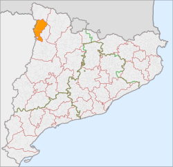
Alta Ribagorça (Catalan pronunciation: [ˈaltə riβəˈɣoɾsə]) is one of the comarques of Catalonia, Spain. Its capital is Pont de Suert. The highest peak is the Comaloformo (3030 metres above sea level) in the massif of Bessiberri. Northeast of the region is the western part of the Aigüestortes i Estany de Sant Maurici National Park. It is connected with the Aran valley thorough the Vielha tunnel.
Alta Ribagorça | |
|---|---|
 | |
| Country | |
| Autonomous community | |
| Province | Lleida |
| Capital | Pont de Suert |
| Municipalities | List
|
| Government | |
| • President of the Comarcal Council | Joan Perelada i Ramon (PSC) |
| Area | |
| • Total | 426.8 km2 (164.8 sq mi) |
| Population (2014) | |
| • Total | 3,873 |
| • Density | 9.1/km2 (24/sq mi) |
| Demonym(s) | Ribagorçan |
| Time zone | UTC+1 (CET) |
| • Summer (DST) | UTC+2 (CEST) |
| Largest municipality | Pont de Suert |
| Website | www.altaribagorça.cat |
The Catalan Romanesque Churches of the Vall de Boí are UNESCO World Heritage Sites.(Nov. 30, 2000). . In the North-East of the area there is the Aigüestortes i Estany de Sant Maurici National Park, which attracts an important number of visitors.
The local Ribagorçan dialect is a variant of Catalan, which has some transitional traits to Aragonese.
Location:
- Farthest east point: 0° 58' 27,80" East longitude.
- Farthest west point: 0° 41' 30,24" East longitude.
- Farthest north point: 42° 37' 58,88" North latitude.
- Farthest south point: 42° 18' 0,07" North latitude.
Highest point: Comaloformo (3030 m) in the Bessiberri Range.
Municipalities
| Municipality | Population(2014)[1] | Areakm2[1] |
|---|---|---|
| El Pont de Suert | 2,318 | 148.1 |
| Vall de Boí | 992 | 219.5 |
| Vilaller | 563 | 59.2 |
| • Total: 3 | 3,873 | 426.8 |
References
- "El municipi en xifres" (in Catalan). Institut d'Estadística de Catalunya. Retrieved 2015-05-25.
External links
- Official site of the Consell Comarcal of Alta Ribagorça
- Information on Alta Ribagorça from the Generalitat de Catalunya
- Information on Alta Ribagorça from the official site of Lleida
Places adjacent to Alta Ribagorça | ||||||||||
|---|---|---|---|---|---|---|---|---|---|---|
| ||||||||||