Aldora, Georgia
Aldora is a town in Lamar County, Georgia, United States. As of the 2010 census, the city had a population of 103.[5]
Aldora, Georgia | |
|---|---|
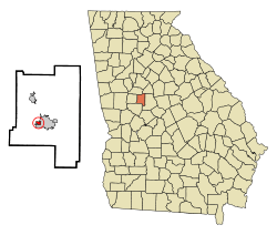 Location in Lamar County and the state of Georgia | |
| Coordinates: 33°2′57″N 84°10′32″W | |
| Country | United States |
| State | Georgia |
| County | Lamar |
| Area | |
| • Total | 0.26 sq mi (0.66 km2) |
| • Land | 0.24 sq mi (0.62 km2) |
| • Water | 0.02 sq mi (0.04 km2) |
| Elevation | 817 ft (249 m) |
| Population (2010) | |
| • Total | 103 |
| • Estimate (2018)[2] | 109 |
| • Density | 456.07/sq mi (176.23/km2) |
| Time zone | UTC-5 (Eastern (EST)) |
| • Summer (DST) | UTC-4 (EDT) |
| FIPS code | 13-01248[3] |
| GNIS feature ID | 0331014[4] |
History
The Georgia General Assembly incorporated Aldora as a town in 1906.[6]
Geography
Aldora is located in south-central Lamar County at 33°2′57″N 84°10′32″W (33.049078, -84.175552).[7] It is bordered to the east by Barnesville, the county seat.
Georgia State Route 18 passes through the south side of the town, leading east into Barnesville and west 14 miles (23 km) to Zebulon. U.S. Route 41 forms the eastern border of the town; US-41 least north 16 miles (26 km) to Griffin and east the same distance to Forsyth.
According to the United States Census Bureau, Aldora has a total area of 0.25 square miles (0.66 km2), of which 0.24 square miles (0.62 km2) are land and 0.02 square miles (0.04 km2), or 6.50%, are water.[8] The town drains west to Little Potato Creek, a tributary of Potato Creek and part of the Flint River watershed.
Demographics
| Historical population | |||
|---|---|---|---|
| Census | Pop. | %± | |
| 1920 | 365 | — | |
| 1930 | 595 | 63.0% | |
| 1940 | 746 | 25.4% | |
| 1950 | 591 | −20.8% | |
| 1960 | 535 | −9.5% | |
| 1970 | 322 | −39.8% | |
| 1980 | 139 | −56.8% | |
| 1990 | 127 | −8.6% | |
| 2000 | 98 | −22.8% | |
| 2010 | 103 | 5.1% | |
| Est. 2018 | 109 | [2] | 5.8% |
| U.S. Decennial Census[9] | |||
As of the census[3] of 2000, there were 98 people, 43 households, and 30 families residing in the town. The population density was 298.1 people per square mile (114.7/km²). There were 45 housing units at an average density of 136.9 per square mile (52.7/km²). The racial makeup of the town was 100.00% White.
There were 43 households, out of which 23.3% had children under the age of 18 living with them, 58.1% were married couples living together, 11.6% had a female householder with no husband present, and 30.2% were non-families. 27.9% of all households were made up of individuals, and 18.6% had someone living alone who was 65 years of age or older. The average household size was 2.28 and the average family size was 2.73.
In the town, the population was spread out, with 19.4% under the age of 18, 4.1% from 18 to 24, 22.4% from 25 to 44, 28.6% from 45 to 64, and 25.5% who were 65 years of age or older. The median age was 50 years. For every 100 females, there were 92.2 males. For every 100 females age 18 and over, there were 92.7 males.
The median income for a household in the town was $22,083, and the median income for a family was $22,083. Males had a median income of $20,625 versus $19,583 for females. The per capita income for the town was $10,693. There were 10.7% of families and 11.8% of the population living below the poverty line, including 25.0% of under eighteens and 16.7% of those over 64.
References
- "2018 U.S. Gazetteer Files". United States Census Bureau. Retrieved Feb 12, 2020.
- "Population and Housing Unit Estimates". Retrieved June 4, 2019.
- "U.S. Census website". United States Census Bureau. Retrieved 2008-01-31.
- "US Board on Geographic Names". United States Geological Survey. 2007-10-25. Retrieved 2008-01-31.
- United States Census
- "Aldora". GeorgiaGov. Retrieved 30 June 2019.
- "US Gazetteer files: 2010, 2000, and 1990". United States Census Bureau. 2011-02-12. Retrieved 2011-04-23.
- "U.S. Gazetteer Files: 2019: Places: Georgia". U.S. Census Bureau Geography Division. Retrieved December 9, 2019.
- "Census of Population and Housing". Census.gov. Retrieved June 4, 2015.
External links
Municipalities and communities of Lamar County, Georgia, United States | ||
|---|---|---|
| Cities | 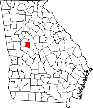 Map of Georgia highlighting Lamar County | |
| Town | ||
| Unincorporated communities | ||