Alberta Highway 519
Alberta Provincial Highway No. 519, commonly referred to as Highway 519, is an east-west highway in southern Alberta, Canada, stretching from Highway 2 near Granum through Picture Butte to Highway 845.[1][3] In tandem with Highway 23, Highway 519 is often used by traffic in the CANAMEX Corridor to bypass Fort Macleod on the route between Calgary and Lethbridge.[4]
| ||||
|---|---|---|---|---|
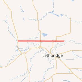
Highway 519 highlighted in red | ||||
| Route information | ||||
| Maintained by Alberta Transportation | ||||
| Length | 65.0 km[1] (40.4 mi) | |||
| History | 1979 (paved)[2] | |||
| Major junctions | ||||
| West end | ||||
| East end | ||||
| Location | ||||
| Specialized and rural municipalities | Willow Creek, Lethbridge | |||
| Towns | Granum, Picture Butte | |||
| Villages | Nobleford | |||
| Highway system | ||||
Provincial highways in Alberta
| ||||

Route description
Highway 519 is a two-lane undivided highway that begins in the Municipal District of Willow Creek in Granum at an intersection with Highway 2.[1] At a speed limit of 60 km/h (37 mph), it proceeds east through the town after which the speed limit increases to 100 km/h (62 mph) and the highway reaches Highway 811 which turns south to Fort Macleod. After crossing into Lethbridge County, It reaches a roundabout at Highway 23 before entering the village of Nobleford and crossing a branch of the Canadian Pacific Railway.[1] North of Shaughnessy, it merges with Highway 25 with which it is briefly concurrent until Picture Butte where Highway 25 splits north to Iron Springs while Highway 519 continues east to end at Highway 845 near the Oldman River.[1]
Major intersections
| Rural/specialized municipality | Location | km[1] | mi | Destinations | Notes |
|---|---|---|---|---|---|
| MD of Willow Creek | Granum | 0.0 | 0.0 | ||
| | 8.2 | 5.1 | |||
| Lethbridge County | | 31.6 | 19.6 | Roundabout | |
| | 49.3 | 30.6 | Western end of Hwy 25 concurrency | ||
| Picture Butte | 52.9 | 32.9 | Eastern end of Hwy 25 concurrency Western end of Hwy 843 concurrency | ||
| 53.8 | 33.4 | Eastern end of Hwy 843 concurrency | |||
| | 65.0 | 40.4 | |||
1.000 mi = 1.609 km; 1.000 km = 0.621 mi
| |||||
References
- Google (November 4, 2016). "Highway 519 in southern Alberta" (Map). Google Maps. Google. Retrieved November 4, 2016.
- "Problem roads will not be ignored". The Lethbridge Herald. January 31, 1984. p. 5.
We've been looking at traffic counts there recently... they took big jumps in 1979 when it [Secondary Road 519] was paved...
- "Provincial Highways 500 - 986 Progress Chart" (PDF). Alberta Transportation. March 2015. Retrieved December 26, 2016.
- "Intersection Assessment: Highway 23/519" (PDF). AMEC Environment & Infrastructure. Lethbridge. February 2013. p. 6. Retrieved November 5, 2016.
This route is now a popular shortcut for motorists wishing to bypass the town of Fort MacLeod...