Alambique Creek
Alambique Creek, or Arroyo Alembique, is a 2.7-mile-long (4.3 km)[2] stream located in San Mateo County, California in the United States. It is part of the San Francisquito Creek watershed.[3]
| Alambique Creek | |
|---|---|
 Location of the mouth in California | |
| Etymology | Spanish language |
| Location | |
| Country | United States |
| State | California |
| Region | Southeastern San Mateo County |
| City | Woodside, California |
| Physical characteristics | |
| Source | |
| ⁃ location | Wunderlich County Park |
| ⁃ coordinates | 37°24′03″N 122°17′20″W[1] |
| ⁃ elevation | 1,930 ft (590 m) |
| Mouth | Sausal Creek |
⁃ location | Just above Searsville Lake |
⁃ coordinates | 37°24′12″N 122°14′52″W[1] |
⁃ elevation | 371 ft (113 m) |
History

The creek's name is Spanish for "still," referring to a liquor distillery.[4] Older Spanish spells it alembique with an "e". The English spelling is alembic, a type of still that is used today. The e spelling dominates in the 1800s and continued on most maps until the 1930s. The name refers to moonshiners Tom Bowen and Nicholas Dawson, English seaman deserters, who built an illegal still on the creek in 1842.[3] The creek runs through Wunderlich Park in Woodside, California, where, in 1904, the creek was used by J. A. Folger for the first hydro-electrical power system in the region.[5]
Watershed
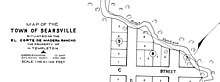
Alambique Creek begins below Skyline Boulevard on Bear Gulch Road near the intersection with Bear Glen Drive.[1] After crossing La Honda Road, and just south of the intersection of Mountain Home Road and Portola Road, Alambique Creek enters a historic wetland pond (Lloyd's Pond) which is currently impounded by the road-fill of Portola Road and a culvert. Next, Alambique Creek flows under Portola Road into the upper Searsville Reservoir at its confluence with Sausal Creek.[6]
Ecology
Alambique Creek was once a historical steelhead trout (coastal rainbow trout) (Oncorhynchus mykiss irideus) spawning stream. In 1981, the creek was fish sampled and two stream resident rainbow trout which have been isolated from the Bay by Searsville Dam were collected where the creek crosses La Honda Road. In May 2002, the culvert beneath Highway 84 was identified as an impassable barrier to upstream migration.[7]
References
- U.S. Geological Survey Geographic Names Information System: Alambique Creek
- U.S. Geological Survey. National Hydrography Dataset high-resolution flowline data. The National Map Archived 2012-04-05 at WebCite, accessed 2012-02-11
- Herb Dengler (1997). "History Recorded in a Name: Alambique Creek". Views. Jasper Ridge Biological Preserve. Archived from the original on 3 August 2011. Retrieved 22 January 2012.
- William Bright; Erwin Gustav Gudde (30 November 1998). 1500 California place names: their origin and meaning. University of California Press. p. 11. ISBN 978-0-520-21271-8. Retrieved 20 January 2012.
- "Wunderlich Park". Division of Parks. County of San Mateo. 2008. Archived from the original on 23 June 2011. Retrieved 22 January 2012.
- Janet M. Sowers (2005). "San Francisquito Watershed and Alluvial Fan, in Creek & Watershed Map of Palo Alto & Vicinity". Oakland Museum of California. Retrieved 2012-02-11.
- Leidy, R.A.; G.S. Becker; B.N. Harvey (2005). "Historical distribution and current status of steelhead/rainbow trout (Oncorhynchus mykiss) in streams of the San Francisco Estuary, California" (PDF). Center for Ecosystem Management and Restoration, Oakland, CA. Retrieved 2012-02-11.