Al-Abdali
Al-Abdali (Arabic: العبدلي) is the 9th district in the Amman Governorate out of the 27 districts, it is named relative to King Abdullah I who founded it during the 1940s. It covers an area of 15 square kilometres (6 sq mi) in the heart of Amman, with a population of 165,333 in 2015.[1] Large parts of the district are residential, but due its geographical location in the center of the city, it contains several important governmental buildings and businesses. The area is known for containing several bus stations serving routes to many cities in Jordan.[2]
Al-Abdali العبدلي | |
|---|---|
District | |
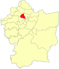 Al-Abdali location in Amman Governorate | |
 Flag | |
| Country | |
| Governorate | Amman Governorate |
| Area | |
| • District | 15 km2 (6 sq mi) |
| Elevation | 800-970 m (2,624-3,185 ft) |
| Population | |
| • Urban | 165,333[1] |
Neighborhoods
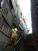
The district consists of 4 neighborhoods Jabal Al-Hussein, Jabal Al-Lweibdeh, Shmeisani, and Al-Madineh Al-Riyadiyah. Jabal Al-Hussein and Jabal Al-Lweibdeh are among the oldest neighborhoods in the city, they have been marked by the Greater Amman Municipality as of great historical significance. They are preferred by several western expatriates who work or study in Amman, as their accommodate.
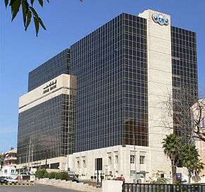
A part of the Shmeisani neighborhood is residential, however, the other part contains several companies, banks, hospitals, schools and governmental buildings. Most notably; Al-Iskan Bank Building, Jordan Hospital, King Abdullah I Mosque, Parliament of Jordan building, Palace of Justice, Royal Cultural Center, Princess Haya Cultural Center, National Orthodox School, Rosary College for girls and numerous embassies. The Al-Madineh Al-Riyadiyah neighborhood contains Al Hussein Sports City while the rest of it is mostly residential.[2]
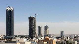
The Central Business District of Amman
It is an Urban redevelopment in Al-Abdali that strives to make Amman a business, commercial and residential hub in the Middle East. The Shmeisani intersection is a multi level intersection that allows easy access to the Project through several tunnels and bridges.
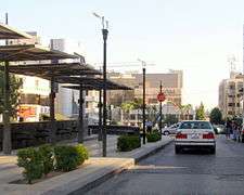
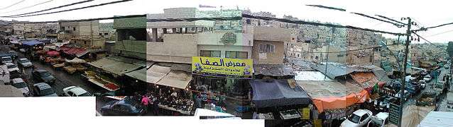
Gallery
References
- "The General Census - 2015" (PDF). Department of Population Statistics.
- "Greater Amman Municipality - GAM Interactive". Archived from the original on 2019-08-12. Retrieved 2015-09-25.
Capital: Amman | |||||||||||
| |||||||||||
| |||||||||||
| |||||||||||
| |||||||||||
| |||||||||||
| |||||||||||
| |||||||||||
| |||||||||||
| |||||||||||