Airport Drive, Missouri
Airport Drive is a village in Jasper County, Missouri, United States. The population was 698 at the 2010 census. It is part of the Joplin, Missouri Metropolitan Statistical Area. The community is still commonly referred to as "Stone's Corner," as the intersection of Route 43 and Route 171 is known.
Airport Drive, Missouri | |
|---|---|
 Location of Airport_Drive, Missouri | |
| Coordinates: 37°8′30″N 94°30′52″W | |
| Country | United States |
| State | Missouri |
| County | Jasper |
| Incorporated | 1947[1] |
| Area | |
| • Total | 2.00 sq mi (5.19 km2) |
| • Land | 2.00 sq mi (5.19 km2) |
| • Water | 0.00 sq mi (0.00 km2) |
| Elevation | 961 ft (293 m) |
| Population | |
| • Total | 698 |
| • Estimate (2018)[4] | 870 |
| • Density | 424.15/sq mi (163.80/km2) |
| Time zone | UTC-6 (Central (CST)) |
| • Summer (DST) | UTC-5 (CDT) |
| FIPS code | 29-00424[5] |
| GNIS feature ID | 0713176[6] |
Geography
Airport Drive is located at 37°8′30″N 94°30′52″W (37.141770, -94.514392).[7] According to the United States Census Bureau, the village has a total area of 2.00 square miles (5.18 km2), all land.[8]
Climate
| Climate data for Airport Drive | |||||||||||||
|---|---|---|---|---|---|---|---|---|---|---|---|---|---|
| Month | Jan | Feb | Mar | Apr | May | Jun | Jul | Aug | Sep | Oct | Nov | Dec | Year |
| Average high °F (°C) | 41 (5) |
48 (9) |
57 (14) |
68 (20) |
75 (24) |
84 (29) |
89 (32) |
87 (31) |
80 (27) |
69 (21) |
55 (13) |
46 (8) |
66 (19) |
| Average low °F (°C) | 24 (−4) |
28 (−2) |
35 (2) |
46 (8) |
55 (13) |
64 (18) |
68 (20) |
66 (19) |
59 (15) |
48 (9) |
35 (2) |
28 (−2) |
46 (8) |
| Average precipitation inches (mm) | 1.8 (46) |
2.3 (58) |
3.3 (84) |
4 (100) |
4.7 (120) |
5.4 (140) |
3.1 (79) |
3.9 (99) |
5 (130) |
3.7 (94) |
3.2 (81) |
2.6 (66) |
42.9 (1,090) |
| Source: Weatherbase [9] | |||||||||||||
Demographics
| Historical population | |||
|---|---|---|---|
| Census | Pop. | %± | |
| 1950 | 225 | — | |
| 1960 | 292 | 29.8% | |
| 1970 | 300 | 2.7% | |
| 1980 | 702 | 134.0% | |
| 1990 | 818 | 16.5% | |
| 2000 | 622 | −24.0% | |
| 2010 | 698 | 12.2% | |
| Est. 2018 | 870 | [4] | 24.6% |
| U.S. Decennial Census | |||
2010 census
As of the census[3] of 2010, there were 698 people, 300 households, and 203 families living in the village. The population density was 349.0 inhabitants per square mile (134.7/km2). There were 312 housing units at an average density of 156.0 per square mile (60.2/km2). The racial makeup of the village was 95.7% White, 1.7% Native American, 0.6% Asian, 0.1% from other races, and 1.9% from two or more races. Hispanic or Latino of any race were 3.4% of the population.
There were 300 households, of which 27.0% had children under the age of 18 living with them, 55.7% were married couples living together, 9.0% had a female householder with no husband present, 3.0% had a male householder with no wife present, and 32.3% were non-families. 26.7% of all households were made up of individuals, and 11.4% had someone living alone who was 65 years of age or older. The average household size was 2.33 and the average family size was 2.77.
The median age in the village was 43.6 years. 20.2% of residents were under the age of 18; 8.5% were between the ages of 18 and 24; 23.2% were from 25 to 44; 28.7% were from 45 to 64; and 19.3% were 65 years of age or older. The gender makeup of the village was 48.6% male and 51.4% female.
2000 census
As of the census[5] of 2000, there were 622 people, 248 households, and 176 families living in the village. The population density was 312.9 people per square mile (120.7/km²). There were 270 housing units at an average density of 135.8 per square mile (52.4/km²). The racial makeup of the village was 93.41% White, 0.32% African American, 2.25% Native American, 0.48% Asian, 0.48% from other races, and 3.05% from two or more races. Hispanic or Latino of any race were 0.80% of the population.
There were 248 households, out of which 25.4% had children under the age of 18 living with them, 59.7% were married couples living together, 8.5% had a female householder with no husband present, and 29.0% were non-families. 23.0% of all households were made up of individuals, and 10.5% had someone living alone who was 65 years of age or older. The average household size was 2.40 and the average family size was 2.82.
In the village, the population was spread out, with 18.3% under the age of 18, 10.5% from 18 to 24, 21.4% from 25 to 44, 29.1% from 45 to 64, and 20.7% who were 65 years of age or older. The median age was 45 years. For every 100 females, there were 100.6 males. For every 100 females age 18 and over, there were 104.0 males.
The median income for a household in the village was $38,750, and the median income for a family was $42,083. Males had a median income of $34,167 versus $23,750 for females. The per capita income for the village was $19,678. About 3.9% of families and 6.8% of the population were below the poverty line, including 12.1% of those under age 18 and none of those age 65 or over.
References
- http://www.sos.mo.gov/cmsimages/publications/municipalities07.pdf
- "2017 U.S. Gazetteer Files". United States Census Bureau. Retrieved Jan 10, 2019.
- "U.S. Census website". United States Census Bureau. Retrieved 2012-07-08.
- "Population and Housing Unit Estimates". Retrieved March 7, 2020.
- "U.S. Census website". United States Census Bureau. Retrieved 2008-01-31.
- "US Board on Geographic Names". United States Geological Survey. 2007-10-25. Retrieved 2008-01-31.
- "US Gazetteer files: 2010, 2000, and 1990". United States Census Bureau. 2011-02-12. Retrieved 2011-04-23.
- "US Gazetteer files 2010". United States Census Bureau. Archived from the original on 2012-01-25. Retrieved 2012-07-08.
- "Weatherbase: Historical Weather for Airport Drive, Missouri". Weatherbase. 2011. Retrieved on November 24, 2011.
Municipalities and communities of Jasper County, Missouri, United States | ||
|---|---|---|
| Cities | 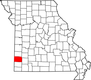 Map of Missouri highlighting Jasper County | |
| Villages | ||
| Townships | ||
| Unincorporated communities | ||
| Ghost town | ||
| Footnotes | ‡This populated place also has portions in an adjacent county or counties | |