Agula
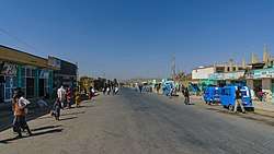
Agula is a town located in northern Ethiopia. Located in the Debubawi (Southern) Zone of the Tigray Region, it lies about 32 km northeast of Mek'ele, just east of the Mek'ele - Addis Ababa highway (Ethiopian Highway 2), and 25 km north of Qwiha. It has a latitude and longitude of 13°41′30″N 39°35′30″E with an elevation of 1930 metres above sea level. Nearby is a stream and a pass (elevation 2030 metres) which share the same name.
Agula | |
|---|---|
 | |
 Flag | |
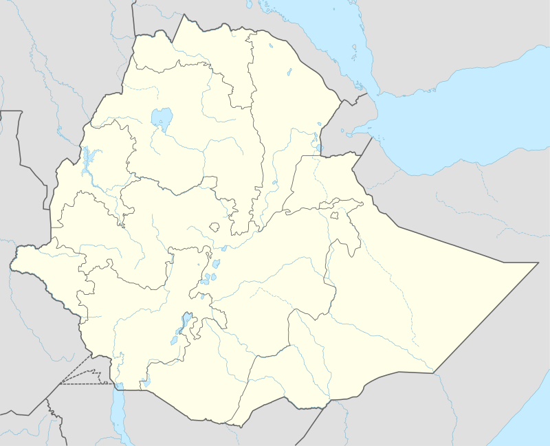 Agula Location within Ethiopia | |
| Coordinates: 13°41′30″N 39°35′30″E | |
| Country | Ethiopia |
| Region | Tigray |
| Zone | Misraqawi (Eastern) |
| Woreda | Kilte Awulaelo |
| Elevation | 1,930 m (6,330 ft) |
| Population (2005) | |
| • Total | 4,636 |
| Time zone | UTC+3 (EAT) |
Agula was an important station on the salt caravan route from Dallol west to Atsbi.[1]
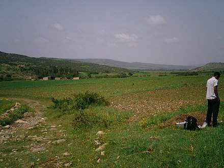
Geology and soils
The following geological formations are present in this locality:[2]
- Agula Shale[3]
- Mekelle Dolerite[4]
- Quaternary alluvium and freshwater tufa[5]
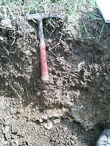 Mollic Calcaric Cambisol in Birki near Agula
The main geomorphic units, with corresponding soil types are:[6]
- Incised Giba plateau (upstream of future Lake Giba
- Associated soil types
- Inclusions
- Ancient river terrace
- Associated soil types
- shallow, stony, dark, loamy soils on calcaric material (Rendzic Leptosol)
- Deep, dark cracking clays with good fertility, but problems of waterlogging (Chromic and Pellic Vertisol)
- moderately deep, red-brownish, loamy soils with a good natural fertility (Chromic Luvisol)
- Brown to dark, silty clay loams to loamy sands developed on alluvium, with good natural fertility (Fluvisol)
- Inclusions
- Associated soil types
History
16th Century
Agula was visited by the Portuguese priest Francisco Álvares on 13 August 1520, who called it Anguguim. He mentions in the town "a well-built church -- upon very thick stone supports; very well hewn" which was dedicated to Saint Chirqos.[7] The town is mentioned again in an inquiry conducted by Emperor Iyasu I in 1698, in which he proclaimed that tolls should no longer be collected there.[8] The village was visited in 1868 by members of the Napier Expedition, who found the church in ruins; they were told that the church had been reduced to its current state by treasure-seekers acting on the orders of Dejazmach Sabagadis. Based on the "limited information now recoverable", David Phillipson assigns the construction of this church a "Late Aksumite or, perhaps, a subsequent date".[9]

20th Century
Records at the Nordic Africa Institute website provide details of a primary school in Agula during the year 1968.[1]
Demographics
Based on figures from the Central Statistical Agency of Ethiopia released in 2005, Agula has an estimated total population of 4,636, of whom 2,229 are men and 2,407 are women.[10] The 1994 census reported it had a total population of 2,666 of whom 1,187 were men and 1,479 were women. It is one of three towns in Kilte Awulaelo woreda.
Notes
- "Local History in Ethiopia" The Nordic Africa Institute website (accessed 24 July 2009)
- Sembroni, A.; Molin, P.; Dramis, F. (2019). Regional geology of the Dogu'a Tembien massif. In: Geo-trekking in Ethiopia's Tropical Mountains — The Dogu'a Tembien District. SpringerNature. ISBN 978-3-030-04954-6.
- Bosellini, A.; Russo, A.; Fantozzi, P.; Assefa, G.; Tadesse, S. (1997). "The Mesozoic succession of the Mekelle Outlier (Tigrai Province, Ethiopia)". Mem. Sci. Geol. 49: 95–116.
- Tefera, M.; Chernet, T.; Haro, W. Geological Map of Ethiopia (1:2,000,000). Addis Ababa, Ethiopia: Ethiopian Institute of Geological Survey.
- Moeyersons, J. and colleagues (2006). "Age and backfill/overfill stratigraphy of two tufa dams, Tigray Highlands, Ethiopia: Evidence for Late Pleistocene and Holocene wet conditions". Palaeogeography, Palaeoclimatology, Palaeoecology. 230 (1–2): 162–178. doi:10.1016/j.palaeo.2005.07.013.
- Nyssen, Jan; Tielens, Sander; Gebreyohannes, Tesfamichael; Araya, Tigist; Teka, Kassa; Van De Wauw, Johan; Degeyndt, Karen; Descheemaeker, Katrien; Amare, Kassa; Haile, Mitiku; Zenebe, Amanuel; Munro, Neil; Walraevens, Kristine; Gebrehiwot, Kindeya; Poesen, Jean; Frankl, Amaury; Tsegay, Alemtsehay; Deckers, Jozef (2019). "Understanding spatial patterns of soils for sustainable agriculture in northern Ethiopia's tropical mountains". PLOS ONE. 14 (10): e0224041. doi:10.1371/journal.pone.0224041. PMC 6804989. PMID 31639144.
- C.F. Beckingham and G.W.B. Huntingford (editors and translators), The Prester John of the Indies (Cambridge: Hakluyt Society, 1961), pp 176-178.
- G.W.B. Huntingford, The historical geography of Ethiopia from the first century AD to 1704, (Oxford University Press: 1989), p. 237
- David W. Phillipson, Ancient Churches of Ethiopia (New Haven: Yale University Press, 2009), pp. 48f
- CSA 2005 National Statistics Archived 2006-11-23 at the Wayback Machine, Table B.4