Aguas Zarcas volcanic field
Aguas Zarcas volcanic field is a field of pyroclastic cones located in the Aguas Zarcas district, San Carlos canton of the Alajuela province, Costa Rica.[1]
| Aguas Zarcas volcanic field | |
|---|---|
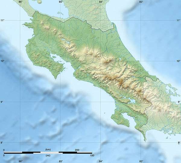 Aguas Zarcas volcanic field Costa Rica | |
| Highest point | |
| Elevation | 621 metres (2,037 ft) (Morera hillock) |
| Listing | List of volcanoes in Costa Rica |
| Coordinates | 10°22′29″N 84°20′20″W |
| Geology | |
| Age of rock | Holocene |
| Mountain type | Volcanic field |
Physical aspects
Located in the North flank of the Platanar Volcano, it is composed of at least nine cones, of which one is recognized as a hill (cerro) and the remaining eight as hillocks (loma).[2][3]
The sides of the cones are slanted between 10 and 30 degrees, the cones have an elongated shape in the East to West direction and the complex runs in the direction North to South, evidence of tectonic origin. Previous lava flow activity is appreciated in some of the cones.[2][4]
Hill and hillocks of the volcanic field
| Name | Elevation (m) | Prominence (m) | Coordinates | Notes |
|---|---|---|---|---|
| Los Chiles hill | 250 | 130 | 10.459027°N 84.340614°W | Also known as Altamira. Largest quarry in the area, east side covered with vegetation. Pineapple production in the surrounding areas. |
| Valle Hermoso hillock | 215 | 50 | 10.446994°N 84.335323°W | Flattest of the cones, surrounded by cattle pasture. |
| Vuelta de Kopper hillock | 290 | 100 | 10.435351°N 84.333596°W | Named due to the nearby town. Very voluminous, elongated shape. There is an access way to the top. |
| Pital hillock | 160 | - | 10.444441°N 84.273369°W | Very eroded. Near the Pital town. |
| Barrantes hillock | 290 | 80 | 10.417244°N 84.306295°W | There is a quarry at the top, and a dense forest covers the remaining structure. There is an access way to the top. |
| Juan Murillo hillocks | 518 | 70 | 10.382865°N 84.328607°W | Crater remains. Located 2 km NE of the town center, easily visible. There is a quarry at its base. |
| Morera hillocks | 621 | 100 | 10.363878°N 84.322150°W | Crater remains. Located 2 km SE of the town center, there is an access way to the top. |
| Buenos Aires hillock | 461 | 60 | 10.378326°N 84.303432°W | Used to be a quarry, but the sides have now recovered vegetation, there is an access way to the top. It is next to Route 140, and the Buenos Aires town is at the other side. |
| Unnamed hillock | 200 | 20 |
See also
References
- Guillermo E. Alvarado Induni; Oscar Luis Chavarría-Aguilar, Guillermo E Alvarado Induni (2005). Costa Rica: Land of Volcanoes. EUNED. pp. 144–. ISBN 978-9968-31-366-7.
- "Aguas Zarcas". Retrieved 14 April 2020.
- Duarte, E. "Los Conos de Escoria de Aguas Zarcas". Retrieved 15 April 2020. Cite journal requires
|journal=(help) - Núñez, Johnny. "Conos volcánicos predominan en Aguas Zarcas". Retrieved 14 April 2020.
| Guatemala |  | |
|---|---|---|
| El Salvador | ||
| Nicaragua | ||
| Costa Rica |
| |
| Panama |
| |
Note: volcanoes are ordered from north-west to south-east. | ||
This article is issued from Wikipedia. The text is licensed under Creative Commons - Attribution - Sharealike. Additional terms may apply for the media files.