Agaete
Agaete is a municipality of Las Palmas province, on the Canary Islands, Spain.
Agaete | |
|---|---|
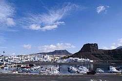 Puerto de las Nieves (Port of the Snows) | |
| Nickname(s): culeto | |
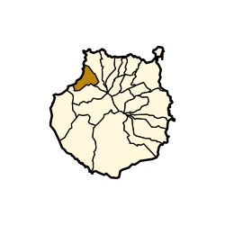 Agaete municipality in Gran Canaria | |
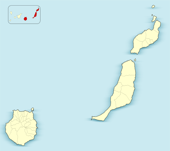 Agaete Location in the province of Las Palmas  Agaete Agaete (Canary Islands)  Agaete Agaete (Spain, Canary Islands) | |
| Coordinates: 28°6′N 15°42′W | |
| Country | |
| Autonomous Region | Canary Islands |
| Province | Las Palmas |
| Island | Gran Canaria |
| Government | |
| Area | |
| • Total | 45.50 km2 (17.57 sq mi) |
| Elevation | 43 m (141 ft) |
| Population (2018)[2] | |
| • Total | 5,573 |
| • Density | 120/km2 (320/sq mi) |
| Time zone | UTC+0 (GMT) |
| Climate | BWh |
| Website | Ayuntamiento de Agaete |
Geography
It is in the north-west of Gran Canaria island, and is enclosed by the Atlantic Ocean to the west, Gáldar to the north-east, and Artenara to the south. Agaete's area is 45.50 km2 (17.57 sq mi)[1] with a population of 5,796 (2003).[3]
Tourism
The port of Agaete, Puerto de las Nieves, used to be the preferred place to get a view of El Dedo de Dios, a natural monument on the coastline, before the latter was destroyed during tropical storm Delta in November 2005. The port is a common end point for day tours from more touristic areas of the island.
Archaeology
El Maipes necropolis is on the outskirts of the town, in the south-east near the football ground.
Gallery
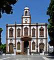 Church of Conception
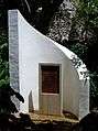 Monument Huerto de las Flores
(the Flowers Garden)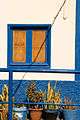 Colours in Agaete
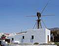 Windmill in Agaete
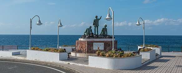 Statue of Los tres poetas in Puerto de las Nieves
.jpg) Ferry connections from Agaete to western Canary Islands
Ferry connections from Agaete to western Canary Islands.jpg) Puerto de las Nieves
Puerto de las Nieves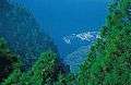 Puerto de las Nieves seen from the Tamadaba mountain
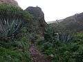 Barranco de Agaete
 Agaete valley
(Valle de Agaete)
| Wikimedia Commons has media related to Agaete. |
Places adjacent to Agaete | ||||||||||
|---|---|---|---|---|---|---|---|---|---|---|
| ||||||||||
See also
References
- Instituto Canario de Estadística, area
- Municipal Register of Spain 2018. National Statistics Institute.
- Instituto Canario de Estadística Archived April 23, 2014, at the Wayback Machine, population
External links
- Ayuntamiento de Agaete
- Photos of Agaete, including Puerto de Las Nieves and the valley, "El Valle"
| |||||||||
| Governance |  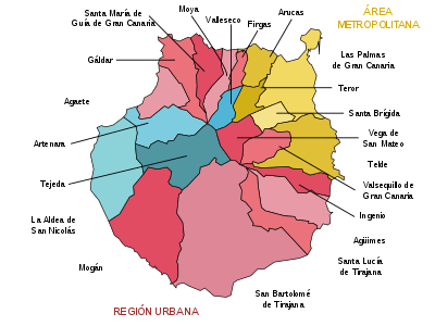 | ||||||||
| Municipalities |
| ||||||||
| History |
| ||||||||
| Nature |
| ||||||||
| Landmarks and attractions |
| ||||||||
| Transport |
| ||||||||
| Sport |
| ||||||||
| Education and science |
| ||||||||
This article is issued from Wikipedia. The text is licensed under Creative Commons - Attribution - Sharealike. Additional terms may apply for the media files.