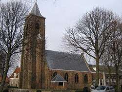
Aagtekerke
Aagtekerke (Dutch pronunciation: [ˈaːxtəˌkɛrkə]) (51°33′N 3°31′E) is a village in the Dutch province of Zeeland. It is a part of the municipality of Veere, and lies about 9 km (6 mi) northwest of Middelburg. In 2001, the village of Aagtekerke had 936 inhabitants. The built-up area was 22 ha (54 acres), and contained 296 residences.[1] The Aagtekerke statistical area, which includes the surrounding countryside and covers an area of 59 ha (146 acres), has a population of around 1,245.[2]
Aagtekerke | |
|---|---|
 | |
 Seal | |
 | |
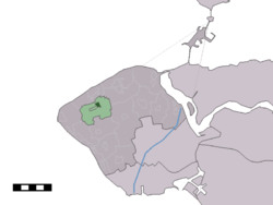 | |
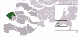
 Aagtekerke Location in the Netherlands | |
| Coordinates: 51°33′N 3°31′E | |
| Country | |
| Province | Zeeland |
| Municipality | Veere |
| Area | |
| • Total | 0.59 km2 (0.23 sq mi) |
| Population | |
| • Total | 1,245 |
| Time zone | UTC+1 (CET) |
| • Summer (DST) | UTC+2 (CEST) |
Until 1 July 1966, Aagtekerke was a separate municipality. On that date, it was merged into the municipality of Mariekerke.[3] Aagtekerke is a conservative Protestant village, located in the Dutch Bible Belt. In the 2010 municipal elections, 62 percent of the local population voted for the Reformed Political Party (SGP). The three Christian parties in the elections (the Reformed Political Party, the ChristianUnion and the Christian Democratic Appeal) gained a combined total of almost 70 percent of the votes.
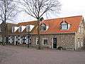 Houses on the village square
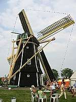 Aagtekerkse mill
References
| Wikimedia Commons has media related to Aagtekerke. |
- Statistics Netherlands (CBS), Bevolkingskernen in Nederland 2001 "Archived copy". Archived from the original on 2006-03-19. Retrieved 2007-01-24.CS1 maint: archived copy as title (link). (Statistics are for the continuous built-up area).
- Ad van der Meer and Onno Boonstra, Repertorium van Nederlandse gemeenten, KNAW, 2006.
External links
- J. Kuyper, Gemeente Atlas van Nederland, 1865-1870, "Aagtekerke". Map of the former municipality in 1868.