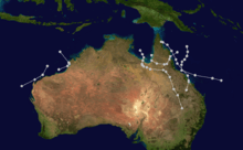
1910–1921 Australian region cyclone seasons
1910–11 cyclone season
Cyclone 1
On 19 November 1911, a cyclone touched land in Western Australia when it had a minimum pressure of 965 hPa.[1]
Cyclone 2
A long-lived weak cyclone formed in the Gulf of Carpenteria on 3 January, and made landfall with a pressure of 996 hPa.[1][2]
Cyclone 3
On 4 January 1911 a cyclone affected the Pilbara coast between Cossack and Onslow. The Glenbank was wrecked off Legendre Island with the loss of all but one of its crew. The cyclone crossed near Mardie Station where nearly every outbuilding was levelled to the ground and 6000-gallon tanks were blown away.[3]
Cyclone 4
This cyclone affected Queensland.[1]
Cyclone 5
Cyclone 5 crossed the Cape York Peninsula.
Cyclone 6
This cyclone approached the Queensland coast near Townsville, Australia, but took a sharp turn away from the coast on 22 March.
Cyclone 7
The cyclone came ashore between Cape Upstart and Cape Bowling Green. The ship Yongala was completely destroyed, with the loss of all 120 people on board.[4]
1911-12 cyclone season
Unnamed tropical cyclone near Port Hedland (1912)
This cyclone crossed the coast just west of Balla Balla near Port Hedland and claimed well over 150 lives. It is almost certainly Australia's worst weather-related maritime disaster since Federation with the loss of the coastal steamer Koombana.[3]
1917-18 cyclone season
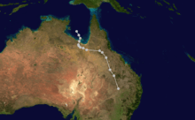
1918 Mackay cyclone
| Precipitation | Storm | Location | Ref. | ||
|---|---|---|---|---|---|
| Rank | mm | in | |||
| 1 | 1,947 | 76.65 | Peter 1979 | Mount Bellenden Ker | [5] |
| 2 | 1,870 | 73.62 | Rona–Frank 1999 | Mount Bellenden Ker | [5] |
| 3 | 1,318 | 51.89 | Wanda 1974 | Mount Glorious | [6] |
| 4 | 1,256.8 | 49.48 | Fletcher 2014 | Kowanyama | [7][8] |
| 5 | 1,082 | 42.60 | Aivu 1989 | Dalrymple Heights | [9] |
| 6 | 1,065 | 41.93 | May 1998 | Burketown | [10] |
| 7 | 1,000 | 39.37 | Justin 1997 | Willis Island | [11] |
| 7 | 1,000 | 39.37 | Ellie 2009 | [12] | |
| 7 | 1,000 | 39.37 | Oswald 2013 | Tully | [13] |
| 8 | 986 | 38.82 | Debbie 2017 | Clarke Range | [14] |
The 1918 Mackay cyclone struck the city of Mackay, Queensland, Australia on 20–21 January 1918.[15] It remains one of the most destructive cyclones to strike a populated centre in Australia.
The eye of the storm passed to the north of the city just after sunrise on 21 January. During the height of the storm, barometric pressure was recorded at 932.6 hPa, one of the lowest recordings in Australia. However, the pressure was probably a lot lower, as the barometer would not go beyond 932.6 hPa, and the eye of the storm did not cross directly over Mackay where the measurement was taken. The meteorologist at the time stated that the barometer was at its maximum low reading for at least 30 minutes before the cyclone moved inland and away, allowing the pressure to finally rise. Few buildings in the centre of Mackay escaped without significant structural damage. The accompanying storm surge resulted in a sea-level-rise of 2.36 metres above the highest spring tide level, with one witness later recalling waves of 2–3 metres breaking in the main street.
Communication links into Mackay were destroyed. The outside world did not learn of the Mackay cyclone until five days after impact, leading to some speculation the city had been completely destroyed.
Record amounts of rainfall were recorded in Mackay, the totals to 9 a.m. are as follows:
- 22 Jan – 627mm
- 23 Jan – 438mm
- 24 Jan – 346mm
- Total rainfall for January – 2161mm
The rainfall resulted in the Pioneer River's highest flood level at the time, which took 2 weeks to subside.
Damage wasn't limited to Mackay. In Rockhampton, over 350 km south of Mackay, houses lost their roofs and solid jacaranda trees were uprooted. Extensive structural damage was also reported in Yeppoon and Mount Morgan. Rainfall associated with the cyclonic system was responsible for the big Rockhampton Flood of 1918 in February.
A total of thirty people perished in the disaster, including two in Rockhampton and another in Yeppoon.
1918 Innisfail cyclone
The 1918 Innisfail cyclone made landfall in the area around Innisfail, Queensland, Australia on 10 March 1918. It was more severe than the earlier Mackay storm. Only 12 houses survived being unroofed or totally destroyed. Damage was also sustained in Cairns, 100 km to the north, and inland to the Atherton Tableland. A 3.6m storm surge was experienced to the south at Mission Beach. 37 people were killed in Innisfail, and an estimated 40 to 60 more in outlying areas. The lowest pressure recorded was 926hPa, but again, damage to recording equipment meant that no accurate minimum for the storm's center survived. Estimates place the figure below 910hPa.[16]
Following this destruction, the area experienced a period of prosperity in the local agricultural industries. This led to the construction of many buildings in a grand art-deco style.
See also
- Pre-1970 Southern Hemisphere tropical cyclone seasons
References
- "BOM Cyclone Database".
- "Untitled".
- BoM – Tropical Cyclones affecting Karratha/Dampier
- http://pandora.nla.gov.au/pan/96122/20090317-1643/www.bom.gov.au/lam/climate/levelthree/c20thc/cyclone7.html
- "Climate Education: Flood". Australian Bureau of Meteorology. Archived from the original on 17 March 2009. Retrieved 18 January 2011.
- Bureau of Meteorology. Tropical Cyclones in Queensland. Retrieved on 17 July 2015.
- "Tropical Cyclone Fletcher Impacts". Bureau of Meteorology. Government of Australia. 2014. Retrieved 5 March 2014.
- "Kowanyama, Queensland February 2014 Daily Weather Observations" (PDF). Bureau of Meteorology. Government of Australia. 2014. Archived from the original (PDF) on 6 March 2014. Retrieved 6 March 2014.
- "Report on Severe Tropical Cyclone Aivu: Rainfall" (PDF). Bureau of Meteorology. Government of Australia. 6 June 1990. p. 17–18. Retrieved 13 March 2014.
- "Tropical Cyclone May". Australian Bureau of Meteorology. 2013. Retrieved 29 January 2013.
- Queensland Tropical Cyclone Warning Centre (2014). "Tropical Cyclone Justin" (PDF). Australian Bureau of Meteorology. Retrieved 11 March 2014.
- "Tropical Cyclone Ellie". Australian Bureau of Meteorology. 2009. Retrieved 27 January 2013.
- Williams, Brian; Michael, Peter (24 January 2013). "Ex-cyclone Oswald heads south with heavy rain tipped for long weekend". The Courier Mail. Australian Associated Press. Archived from the original on 24 January 2013. Retrieved 24 January 2013.
- http://www.bom.gov.au/announcements/sevwx/qld/qldtc20170325.shtml
- "100 years ago, a cyclone without a name killed 30 people and almost levelled a young city". Australian Broadcasting Corporation. 20 January 2018. Retrieved 20 January 2018.
- Historical Impacts Along The East Coast