1679 Armenia earthquake
The 1679 Armenia earthquake (also called Yerevan earthquake or Garni earthquake) took place on June 4 in the Yerevan region of Armenia, then part of the Persian Empire.[1]
 | |
| Local date | June 4, 1679[1] |
|---|---|
| Magnitude | 6.4 Ms[2] |
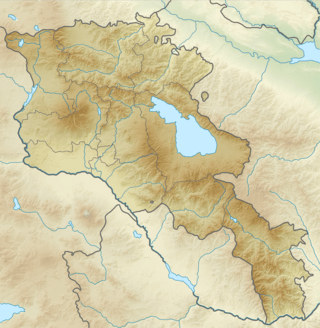
| Epicenter | 40.2°N 44.7°E [2] |
| Areas affected | Yerevan Province, Persian Empire |
| Max. intensity | IX–X[2] |
| Casualties | 7,600[2] |
Numerous buildings were destroyed as a result of the earthquake. In Yerevan most notable structures were damaged. The Yerevan Fortress was destroyed completely, so were the following churches: Poghos-Petros, Katoghike, Zoravor and the Gethsemane Chapel.[1]
Furthermore, the nearby Kanaker village was completely destroyed. The classical Hellenistic Temple of Garni also collapsed.[3] Among many churches and monasteries that were reduced to ruins were Havuts Tar, Saint Sargis Monastery of Ushi, Hovhannavank, Geghard, and Khor Virap.[3]
References
- Hakobyan, Tadevos (1979). Երևանի պատմությունը (1500–1800 ԹԹ.) [History of Yerevan (1500–1800)] (in Armenian). Yerevan State University Press. p. 328.
- Utsu, T. R. (2002), "A List of Deadly Earthquakes in the World: 1500–2000", International Handbook of Earthquake & Engineering Seismology, Part A, Volume 81A (First ed.), Academic Press, p. 69, ISBN 978-0124406520
- Hasrat'yan, Mourad (1995). "The medieval earthquakes of the Armenian Plateau and the historic towns of Ayrarat and Shirak (Dvin, Ani, Erevan)". Annali di Geofisica. Italian National Institute of Geophysics. 38 (5–6): 721.
This article is issued from Wikipedia. The text is licensed under Creative Commons - Attribution - Sharealike. Additional terms may apply for the media files.