Zvimba District
| Zvimba District | |
|---|---|
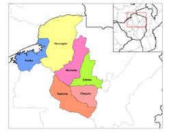 Zvimba District (light green) in Mashonaland West Province | |
| Coordinates: 17°42′S 30°12′E / 17.700°S 30.200°E | |
| Country | Zimbabwe |
| Province | Mashonaland West |
Zvimba District is a district of Mashonaland West Province, Zimbabwe.
Location
The district is located in Mashonaland West Province, in central northern Zimbabwe. Zvimba District is bordered by Guruve District to the north, Mazowe District to the east, the city of Harare to the southeast, Chegutu District to the south, Kadoma District to the southwest and Makonde District to the west and northwest.
Its main town, Murombedzi, is located about 110 kilometres (68 mi) by road west of Harare, the capital and largest city of Zimbabwe. The district lies about 48 kilometres (30 mi) by road, south of the town of Chinhoyi, Makonde District, the nearest large town.[1]
History of Chief Zvimba
The Zvimba chieftainship was founded by Neuteve Chihobvu who migrated from Guru Uswa. When he arrived in the area now known as Zvimba he complained that his feet were swollen, (Nda zvimba makumbo). He was thereafter called Zvimba. The land now called Zvimba then belonged to the Rozvi tribe then headed by Tambare. Tambare allocated the land to Neuteve (Zvimba). Neuteve became the first chief Zvimba.
Overview
Zvimba District is primarily a farming and ranching district. Crops raised include tobacco, maize and cotton. Cattle are raised for dairy products and beef.
Education
A fair number of primary and secondary schools are located in Zvimba District, the most well-known being a private, selective school called Cornway College in Mt. Hampden on the outskirts of Zvimba and in very close proximity to Harare. Kutama College previously known as (St Francis Xavier College) is an all-boys high school located near the town of Norton in the Zvimba area, 80 kilometres southwest of the Zimbabwean capital Harare.
Population
The current population of Zvimba District is not publicly known. The 1992 national census put the population in the district at 230,703 people.[2] The next national population census in Zimbabwe is scheduled from 18 August 2012 through 28 August 2012.[3] Other urban areas aside from Murombedzi, the district capital, include the small town of Banket, about 25 kilometres (16 mi), southeast of Chinhoyi on the road to Harare.