Zuma, Sudan
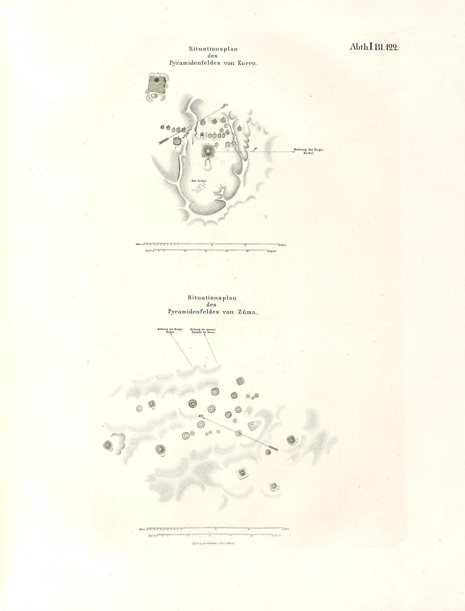
Zuma is an archaeological site including a village and burial ground about 25 miles (40 km) downstream from Jebel Barkal in what is now Sudan. It lies about 10 kilometres (6.2 mi) south of El-Kurru, in the Napatan Region, on the right side of the Nile. The cemetery was visited several times by researchers in the last two hundred years, but there were only brief descriptions written, and no excavations. A plan was drawn up during the expedition of Karl Richard Lepsius. UNESCO inscribed Zuma's 20 hectares as a world cultural heritage site in 2003.[1]
Modern, systematic excavations began in December 2004 by a Polish-Sudanese team. On the surface, 29 grave mounds are seen. Three grave types are distinguished, mainly based on the grave mound. Type I consists of hills, which are completely covered with stones. The grave mounds have a diameter of 25–53 metres (82–174 ft) and were 6–13.5 metres (20–44 ft) high. The hills of type II have a diameter of 21–31 metres (69–102 ft). They are built of sand and loose stones. A stone ring that goes around the hill keeps them together. The underground burial shaft is M-shaped (when viewed from above) and has two chambers, one for the funeral and the other for the grave goods. The hills of type III are flat and less than 1 metre (3 ft 3 in) high. They have a diameter of 9–20 metres (30–66 ft) and only a single grave chamber. All grave chambers were robbed. However, they showed evidence of having contained pottery, beads, metal fragments and animal bones. Ceramics found in the graves dated late 5th and early 6th centuries.
References
- El-Tayeb, Mahmoud: "Early Maukrua Research Project, Excavations at El-Zuma, Preliminart Report". In: Polish Archaeology in the Mediterranean, XVI (2004), pp. 389–399
- Obluski, Artur: "Remarks on a Survey of the Tumuli Field at El-Zuma". In: Polish Archaeology in the Mediterranean, XVI (2004), pp. 400–403
- Osypinska, Marta: "Animal Bones from the Excavations at Ez-Zuma". In: Polish Archaeology in the Mediterranean XVI (2004), pp. 404–408
Footnotes
- ↑ "Gebel Barkal and the Sites of the Napatan Region". UNESCO. Retrieved 27 July 2012.