Zuiddorpe
| Zuiddorpe | ||
|---|---|---|
| Village | ||
| ||
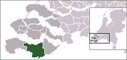 | ||
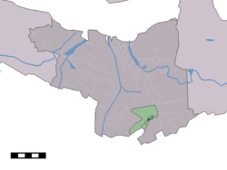 The village centre (dark green) and the statistical district (light green) of Zuiddorpe in the municipality of Terneuzen. | ||
| Coordinates: 51°14′3″N 3°54′6″E / 51.23417°N 3.90167°ECoordinates: 51°14′3″N 3°54′6″E / 51.23417°N 3.90167°E | ||
| Country | Netherlands | |
| Province | Zeeland | |
| Municipality | Terneuzen | |
| Population (31 December 2009) | ||
| • Total | 956 | |
| Time zone | UTC+1 (CET) | |
| • Summer (DST) | UTC+2 (CEST) | |
| Postal code | 4574 | |
Zuiddorpe is a village in the Dutch province of Zeeland. It is a part of the municipality of Terneuzen, and lies about 34 km southeast of Vlissingen.
Zuiddorpe was a separate municipality until 1970, when it was merged with Axel.[1]
In 2001, the village of Zuiddorpe had 533 inhabitants. The built-up area of the village was 0.16 km², and contained 224 residences.[2] The statistical area "Zuiddorpe", which also can include the surrounding countryside, has a population of around 1000.[3]
References
- ↑ Ad van der Meer and Onno Boonstra, Repertorium van Nederlandse gemeenten, KNAW, 2006.
- ↑ Statistics Netherlands (CBS), Bevolkingskernen in Nederland 2001 Archived March 19, 2006, at the Wayback Machine.. (Statistics are for the continuous built-up area).
- ↑ Statistics Netherlands (CBS), Statline: Kerncijfers wijken en buurten 2003-2005 Archived 2006-07-24 at WebCite. As of 1 January 2005.
External links
- J. Kuyper, Gemeente Atlas van Nederland, 1865-1870, "Zuiddorpe". Map of the former municipality, around 1868.
This article is issued from
Wikipedia.
The text is licensed under Creative Commons - Attribution - Sharealike.
Additional terms may apply for the media files.