Zohar, Israel
| Zohar זוהר, זֹהַר | |
|---|---|
 Zohar | |
| Coordinates: 31°35′43.27″N 34°41′32.1″E / 31.5953528°N 34.692250°ECoordinates: 31°35′43.27″N 34°41′32.1″E / 31.5953528°N 34.692250°E | |
| District | Southern |
| Council | Lakhish |
| Affiliation | Agricultural Union |
| Founded | 1956 |
| Founded by | Algerian and Tunisian Jews |
| Population (2017) | 443[1] |
| Name meaning | Brightness |
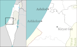
Zohar (Hebrew: זֹהַר, lit. Brightness) is a moshav in southern Israel. Located near the city of Kiryat Gat, it falls under the jurisdiction of Lakhish Regional Council. In 2017 it had a population of 443.[1]
A large lake that serves as a reservoir lies near the town.
History
The moshav was founded in 1956 by Jewish refugees from Algeria and Tunisia on land, that had belonged to the Arab village of al-Faluja,[2] as part of the effort to settle Hevel Lakhish.
According to Walid Khalidi, Zohar is founded on the land belonging to the depopulated Palestinian village of Burayr.[3]
Its name signifies the desire of the inhabitants to be quickly absorbed in what was then a remote frontier region. In later years, new immigrants from Iraq, Russia and Hungary settled there.
In the 1950s and 1960s the moshav was a target for Palestinian fedayeen who infiltrated into Israel from Gaza.
References
- 1 2 "List of localities, in Alphabetical order" (PDF). Israel Central Bureau of Statistics. Retrieved August 26, 2018.
- ↑ Carta's Official Guide to Israel and Complete Gazetteer to all Sites in the Holy Land. (3rd edition 1993) Jerusalem, Carta, p.485, ISBN 965-220-186-3
- ↑ Khalidi, Walid (1992). All That Remains: The Palestinian Villages Occupied and Depopulated by Israel in 1948. Washington D.C.: Institute for Palestine Studies. p. 92. ISBN 0-88728-224-5.