Zhvanets
| Zhvanets Жванець | |
|---|---|
| Village | |
 | |
 Zhvanets  Zhvanets | |
| Coordinates: 48°33′00″N 26°29′15″E / 48.55000°N 26.48750°ECoordinates: 48°33′00″N 26°29′15″E / 48.55000°N 26.48750°E | |
| Country |
|
| Region |
|
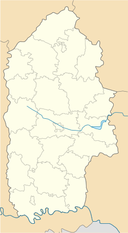
| District | Kamianets-Podilskyi Raion |
| Area | |
| • Total | 2.995 km2 (1.156 sq mi) |
| Population (2001) | |
| • Total | 1,529 |
| • Density | 510/km2 (1,300/sq mi) |
| Time zone | UTC+2 (EET) |
| • Summer (DST) | UTC+3 (EEST) |
| Postal code | 32365 |
| Area code | +380 3849 |
| Website | |
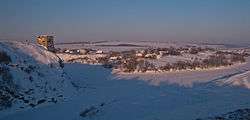
Zhvanets (Ukrainian: Жванець) is a village (a selo) in the Kamianets-Podilskyi Raion (district) of Khmelnytskyi Oblast in Western Ukraine. The village's population was 1,529 as of the 2001 Ukrainian census.[1]
See
External links
References
| Urban-type settlements | ||
|---|---|---|
| Rural councils |
| |
This article is issued from
Wikipedia.
The text is licensed under Creative Commons - Attribution - Sharealike.
Additional terms may apply for the media files.