Zemmoura
| Zemmoura زمورة | |
|---|---|
| Commune and town | |
 | |
 | |
 Zemmoura | |
| Coordinates: 35°43′N 0°45′E / 35.717°N 0.750°E | |
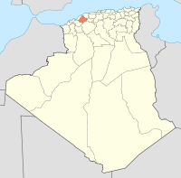
| Country |
|
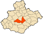
| Province | Relizane Province |
| District | Zemmoura District |
| Area | |
| • Total | 94.08 sq mi (243.67 km2) |
| Population (2008) | |
| • Total | 30,027 |
| Time zone | UTC+1 (CET) |
| Postal Code | 48155 |
Zemmoura is a town and commune in Relizane Province, Algeria.[1]
References
- ↑ "Communes of Algeria". Statoids. Retrieved December 12, 2010.
This article is issued from
Wikipedia.
The text is licensed under Creative Commons - Attribution - Sharealike.
Additional terms may apply for the media files.