Zell, Missouri
| Zell, Missouri | |
|---|---|
| unincorporated community | |
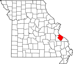 Location of Ste. Genevieve County, Missouri | |
| Coordinates: 37°57′09″N 90°08′34″W / 37.95250°N 90.14278°WCoordinates: 37°57′09″N 90°08′34″W / 37.95250°N 90.14278°W[1] | |
| Country | United States |
| State | Missouri |
| County | Sainte Genevieve |
| Township | Ste. Genevieve |
| Elevation[1] | 623 ft (190 m) |
| Time zone | UTC-6 (Central (CST)) |
| • Summer (DST) | UTC-5 (CDT) |
| ZIP code | 63670 |
| Area code(s) | 573 |
| FIPS code | 29-81466[2] |
Zell is an unincorporated community located in Ste. Genevieve Township in Sainte Genevieve County, Missouri. Zell is located about six miles west of Sainte Genevieve, Missouri.[3]
Name
Zell is named for the town of Zell am Harmersbach in the Baden region of the German state of Baden-Württemberg, located about 10 miles southeast of Offenburg, from where its settlers had originally come.[4]
History
What is now Zell was first settled in 1798 when 1,000 arpents of land (1 arpent = 0.8507 acres (0.3443 ha)) were granted to Pierre Charles Dehault Delassus Deluziere, which he called the Prairie Gautier Tract. In 1819, following Delassus' death, this land was sold to his son Charles Dehault Delassus, and then shortly after to Charles’ nephew Felix de St. Vrain.
In 1837 German Catholics arrived, at which time the location was known as Nouvelle Alsace (French: New Alsace), and was subsequently renamed Zell in 1840. The Catholic church of St. Joseph was built between 1845-1847.[5][6]
Geography
Zell is located in Ste. Genevieve Township.[1] The site is just northeast of Interstate 55 along Missouri Route A.[7]
References
- 1 2 3
- ↑ Roadsidethoughts.com http://www.roadsidethoughts.com/mo/zell-misc.htm
- ↑ Histopolis.com http://www.histopolis.com/Place/US/MO/Sainte_Genevieve_County/Zell
- ↑ State Historical Society of Missouri: Ste. Genevieve County http://shs.umsystem.edu/manuscripts/ramsay/ramsay_sainte_genevieve.html
- ↑ Rome of the West: Saint Joseph Church in Zell http://www.romeofthewest.com/2008/01/photos-of-saint-joseph-church-in-zell.html
- ↑ Mississippi Valley Architecture.com http://www.krjarch.com/zell.asp
- ↑ Weingarten, Missouri, 7.5 Minute Topographic Quadrangle, USGS, 1980
Municipalities and communities of Sainte Genevieve County, Missouri, United States | ||
|---|---|---|
| Cities | | |
| Townships | ||
| CDPs | ||
| Other communities | ||
| Ghost towns | ||