Zaki, Nigeria
| Zaki | |
|---|---|
| LGA | |
 Zaki Location in Nigeria | |
| Coordinates: 12°08′N 10°17′E / 12.133°N 10.283°ECoordinates: 12°08′N 10°17′E / 12.133°N 10.283°E | |
| Country |
|
| State | Bauchi State |
| Area | |
| • Total | 1,436 km2 (554 sq mi) |
| Population (2006 census) | |
| • Total | 191,457 |
| Time zone | UTC+1 (WAT) |
| 3-digit postal code prefix | 752 |
| ISO 3166 code | NG.BA.ZA |
Zaki is a Local Government Area of Bauchi State, Nigeria. Its headquarters are in the town of Katagum.
It has an area of 1,436 km² and a population of 191,457 at the 2006 census.
The postal code of the area is 752.[1]
The predominant ethnic group in the area are the Hausa with some Kanuri and Kare in the east of the area.[2]
The Bade language is spoken in Zaki LGA.[3]
References
- ↑ "Post Offices- with map of LGA". NIPOST. Archived from the original on 2012-11-26. Retrieved 2009-10-20.
- ↑ "State maps". Nigerian National Bureau of Statistics. Retrieved 2010-05-19.
- ↑ "Bade". Ethnologue. Retrieved 2014-05-25.
State capital: Bauchi | ||
| Local Government Areas | 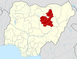 | |
This article is issued from
Wikipedia.
The text is licensed under Creative Commons - Attribution - Sharealike.
Additional terms may apply for the media files.