Yongmabong
| Yongmabong | |
|---|---|
  Yongmabong Location | |
| Highest point | |
| Elevation | 348 m (1,142 ft) |
| Coordinates | 37°34′17″N 127°05′46″E / 37.57128°N 127.09611°ECoordinates: 37°34′17″N 127°05′46″E / 37.57128°N 127.09611°E |
| Geography | |
| Location | South Korea |
| Climbing | |
| Easiest route | Yongmasan Station |
| Korean name | |
| Hangul | 용마봉 |
|---|---|
| Hanja | 龍馬峰 |
| Revised Romanization | Yongmabong |
| McCune–Reischauer | Yongmabong |
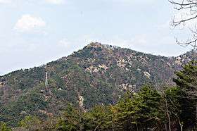
Yongmabong is a mountain in Seoul, South Korea. It extends across Guui-dong and Junggok-dong in the district of Gwangjin-gu. It has an elevation of 348 m (1,142 ft).[1]
See also
Notes
- ↑ Yu 2007, p.99.
References
- Yu Jeong-yeol (2007). 한국의 산 여행 (Travel Guide to Korean Mountains). Seoul: 관동 상억연구회 (Kwandong). ISBN 978-89-958055-1-0.
This article is issued from
Wikipedia.
The text is licensed under Creative Commons - Attribution - Sharealike.
Additional terms may apply for the media files.