Yongan Market MRT station
Yongan Market O03 永安市場 | |
|---|---|
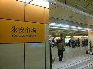 Yongan Market station platform 1 concourse | |
| Location |
No. 388, Zhonghe Rd. Zhonghe and Yonghe, New Taipei Taiwan |
| Operated by | |
| Line(s) |
|
| Connections | Bus stop |
| Construction | |
| Structure type | Underground |
| History | |
| Opened | 24 December 1998 |
| Traffic | |
| Passengers |
50,596 daily (2016)[1] (Ranked 25th of 109) |
| Yongan Market MRT station | |||||||||||||
| Traditional Chinese | 永安市場站 | ||||||||||||
|---|---|---|---|---|---|---|---|---|---|---|---|---|---|
| Simplified Chinese | 永安市场站 | ||||||||||||
| |||||||||||||
The Taipei Metro Yongan Market station is a station on the Zhonghe Line (part of the Orange Line) located in Zhonghe and Yonghe districts, New Taipei, Taiwan.
Station overview
This four-level, underground station has two stacked side platforms (a split platform configuration) and one exit.[2][3] The platforms are aligned parallel to one another.
Station layout
| Street Level | Exit/Entrance | Exit/Entrance |
| B1 | Faliar Floor | Elevator, floor to connecting and orange platform |
| B2 | Concourse | Lobby, toilets, one-way ticket machine, information desk |
| Side platform, doors will open on the right | ||
| Platform 1 | ← | |
| B4 | Side platform, doors will open on the left | |
| Platform 2 | → | |
Exits
- Single Exit: Zhonghe Rd.

Around the station
- Museum of World Religions
- National Taiwan Library
- 823 Memorial Park
- Lehua Night Market (between this station and Dingxi station)
- Northern Regional Office of Taiwan Water Corp.
- Simple Mart Baojian (between this station and Jingan station)
- Yonghe Elementary School
- Yongan Market
| Preceding station | Following station | |||
|---|---|---|---|---|
| Dingxi | Zhonghe–Xinlu line | Jingan towards Nanshijiao | ||
References
| Wikimedia Commons has media related to Yongan Market Station. |
- ↑ "Passenger Volume at Taipei Rapid Transit Stations" (PDF). Taipei City Department of Transportation. 2017-03-13. Retrieved 2017-03-13.
- ↑ "Route Map: Yongan Market". Taipei Rapid Transit Corporation. Retrieved 2010-06-16.
- ↑ "Yongan Market Station Location Map". Taipei Rapid Transit Corporation. Retrieved 2010-06-16.
| Stations |
| ||||||
|---|---|---|---|---|---|---|---|
| Rolling stock |
| ||||||
Coordinates: 25°00′08″N 121°30′38″E / 25.00222°N 121.51056°E
This article is issued from
Wikipedia.
The text is licensed under Creative Commons - Attribution - Sharealike.
Additional terms may apply for the media files.