Ymer Island
| Ymer Ø (Danish) | |
|---|---|
3.jpg) View of Ymer Island with ice floes in the foreground. | |
 Ymer Island Ymer Island (Greenland) | |
| Geography | |
| Location | East Greenland |
| Coordinates | 73°09′N 24°20′W / 73.150°N 24.333°WCoordinates: 73°09′N 24°20′W / 73.150°N 24.333°W |
| Area | 2,437 km2 (941 sq mi) |
| Length | 91 km (56.5 mi) |
| Width | 36 km (22.4 mi) |
| Highest elevation | 1,900 m (6,200 ft) |
| Highest point | Angelin Bjerg[1] |
| Administration | |
| Demographics | |
| Population | 0 |
Ymer Island (Danish: Ymer Ø) is an island in northeastern Greenland. The island is a part of Northeast Greenland National Park.
Ymer Island is named after the giant Ymir, the forefather of the Jotuns in Norse mythology.
Geography
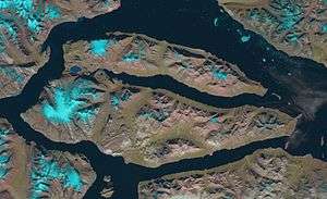
The island lies on the southern side of the entrance of Kaiser Franz Joseph Fjord. Ymer Island's northern half forms a peninsula named Gunnar Anderson Land having its narrow isthmus in the west. The fjord between the two halves of the island is named Dusen Fjord.
Ymer Island has an area of 2,437 km².[2] It is mountainous; Angelin Bjerg, its highest peak, reaches a height of 1900 m. The conspicuous Devil's Castle (Teufelsschloss) is located on the other side of Kaiser Franz Joseph Fjord, off the southern shore of Cape Petersens, the NW extremity of Ymer Island.[3]
6.jpg)
See also
References
- ↑ Angelin Bjerg - Peakbagger.com
- ↑ UNEP
- ↑ Prostar Sailing Directions 2005 Greenland and Iceland Enroute, p. 120
External links
