Yerkes (crater)
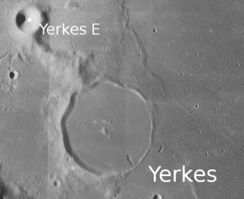
 LRO satellite image including its only satellite crater, Yerkes E | |
| Coordinates | 14°36′N 51°42′E / 14.6°N 51.7°ECoordinates: 14°36′N 51°42′E / 14.6°N 51.7°E |
|---|---|
| Diameter | 36 km |
| Depth | None |
| Colongitude | 310° at sunrise |
| Eponym | Charles T. Yerkes |


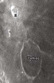
Yerkes is a lunar impact crater near the western edge of Mare Crisium. At this location as does with other craters at that longitude, on Earth, the crater appears oval due to foreshortening, but the crater is actually nearly circular. To the east of Yerkes is the crater Picard, to the southeast are the Greaves-Lick crater pair, to the southwest is Glaisher, about 115 km west-northwest is Proclus, and farther to the north is Peirce.
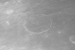
In the past the interior of this crater has been almost completely inundated by lava, leaving only a shallow remnant of a rim above the mare. The rim is widest on the western and southern portions, and barely existent to the east, forming a thin curve in the surface. A low ridge runs from the north rim to Yerkes E in the north-northwest. The floor has a similar albedo to the nearby mare, so the feature is not sharply distinguished from the surroundings. The crater has a rounded hill in the center that rises approximately 150 m above the surrounding crater floor. Inside the crater are a few small rays that originated from Proclus, and a few are also found north of the crater and around Yerkes E.
Touching the eastern crater rim is Dorsum Oppel, a wrinkle ridge that trends northeast, and which is approximately 268 km long.
From that location the Earth would mainly appear in the lunar sky at 14 degrees from the top and it is seen more than 51 degrees towards the east.
Satellite craters
By convention these features are identified on lunar maps by placing the letter on the side of the crater midpoint that is closest to Yerkes. Yerkes E was approved by the IAU in 2006, and V was approved in 2018.
| Yerkes | Latitude | Longitude | Diameter |
|---|---|---|---|
| E | 15.90° N | 50.67° E | 9.91 km |
| V | 15.24° N | 50.49° E | 3.7 km |
References
- Andersson, L. E.; Whitaker, E. A. (1982). NASA Catalogue of Lunar Nomenclature. NASA RP-1097.
- Blue, Jennifer (July 25, 2007). "Gazetteer of Planetary Nomenclature". USGS. Retrieved 2007-08-05.
- Bussey, B.; Spudis, P. (2004). The Clementine Atlas of the Moon. New York: Cambridge University Press. ISBN 978-0-521-81528-4.
- Cocks, Elijah E.; Cocks, Josiah C. (1995). Who's Who on the Moon: A Biographical Dictionary of Lunar Nomenclature. Tudor Publishers. ISBN 978-0-936389-27-1.
- McDowell, Jonathan (July 15, 2007). "Lunar Nomenclature". Jonathan's Space Report. Retrieved 2007-10-24.
- Menzel, D. H.; Minnaert, M.; Levin, B.; Dollfus, A.; Bell, B. (1971). "Report on Lunar Nomenclature by the Working Group of Commission 17 of the IAU". Space Science Reviews. 12 (2): 136–186. Bibcode:1971SSRv...12..136M. doi:10.1007/BF00171763.
- Moore, Patrick (2001). On the Moon. Sterling Publishing Co. ISBN 978-0-304-35469-6.
- Price, Fred W. (1988). The Moon Observer's Handbook. Cambridge University Press. ISBN 978-0-521-33500-3.
- Rükl, Antonín (1990). Atlas of the Moon. Kalmbach Books. ISBN 978-0-913135-17-4.
- Webb, Rev. T. W. (1962). Celestial Objects for Common Telescopes (6th revised ed.). Dover. ISBN 978-0-486-20917-3.
- Whitaker, Ewen A. (1999). Mapping and Naming the Moon. Cambridge University Press. ISBN 978-0-521-62248-6.
- Wlasuk, Peter T. (2000). Observing the Moon. Springer. ISBN 978-1-85233-193-1.
External links
| Wikimedia Commons has media related to Yerkes (crater). |