Yarnbrook
| Yarnbrook | |
|---|---|
| Hamlet | |
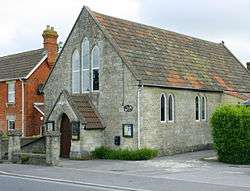 Baptist Chapel, Yarnbrook | |
 Yarnbrook  Yarnbrook  Yarnbrook | |
| Coordinates: 51°17′42″N 2°11′28″W / 51.295°N 2.191°WCoordinates: 51°17′42″N 2°11′28″W / 51.295°N 2.191°W | |
| Country |
|
| Constituent Country |
|
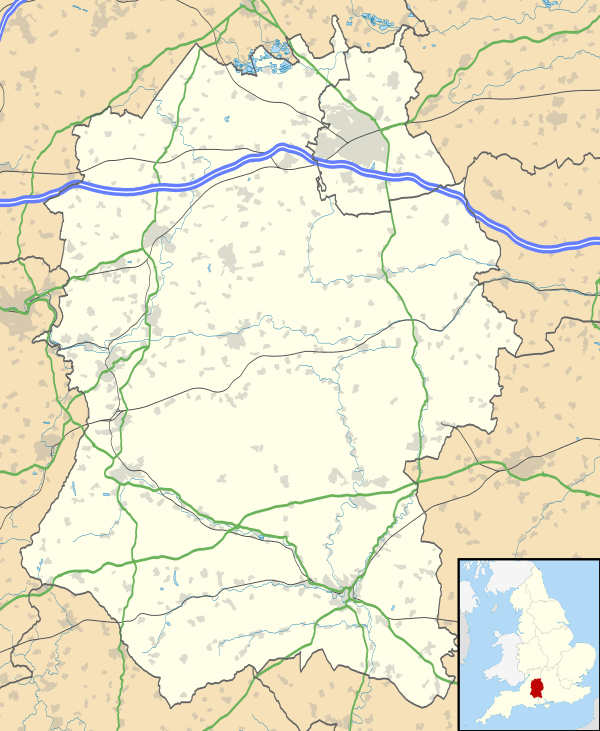
| County | Wiltshire |
Yarnbrook is a large hamlet in Wiltshire, England, between the towns of Westbury and Trowbridge. Most of it lies in the civil parish of North Bradley, the rest in West Ashton. Most of the settlement's houses stand on the A350 road, which runs between the M4 motorway near Chippenham and the south coast of England at Poole, Dorset.
History
Yarnbrook has never been a parish in its own right, but the name dates from at least the 16th century. In 1581 the Will of Agnes Guley, widow of Yarnbrook in North Bradley, was proved at Salisbury.[1] In the Middle Ages Yarnbrook was within Selwood Forest, and the ancient woodland called Picket Wood which stands to the east of the present-day settlement is one of the few surviving areas of Selwood.[2] The first edition of the Andrews and Dury map of Wiltshire (1773) shows only Bradley Mill and a few other houses at Yarnbrook.[3]
The hamlet grew up around a crossroads where what is now the A350 meets the A363 and where a pub, now called the Longs Arms and Hungry Horse, has existed since 1803, when it was first built. This was recorded as "the Long's Arms, Yarnbrook", in 1842.[4]
Until 1805 a large area of common land called Yarnbrook Common stretched from Yarnbrook to the boundaries of Westbury, and after this was enclosed several terraces of small workmen's cottages were added to Yarnbrook. In 1874 a Baptist chapel was built to seat 120 people.[5] After the First World War, housing development began to spread along the Westbury Road.[2] In the mid 20th century a petrol filling station was opened at the former crossroads, immediately opposite the Longs Arms, and as traffic levels increased the crossroads was converted into a roundabout. The filling station operates 24 hours a day. The filling station also has a shop on site called Hursts selling groceries, newspapers etc.
Yarnbrook Road briefly made the national news on 2nd/3rd July 2017 when a £140,000 Maclaren supercar crashed into the offices of Craddock Tractors Ltd and exploded, on the southern edge of the hamlet. Both occupants of the car escaped with minor injuries.
References
- ↑ Cliff Webb, Wills at Salisbury: 1464-1858, Vol. 122 (British Record Society, 2009), p. 598
- 1 2 Elizabeth Crittall, ed., 'North Bradley' in The Victoria History of Wiltshire, vol. VIII, Warminster, Westbury and Whorwellsdown Hundreds (University of London: Institute of Historical Research, 1965), pp. 218-234
- ↑ Elizabeth Crittall, ed., Andrews and Dury's map of Wiltshire, 1773: a reduced facsimile (Wiltshire Record Society Volume 8, 1952), plate 7
- ↑ K. H. Rogers, ed., Early Trade Directories of Wiltshire (Wiltshire Record Society Volume 47, 1991), p. 148
- ↑ "Baptist Chapel, Yarnbrook, North Bradley". Wiltshire Community History. Wiltshire Council. Retrieved 15 February 2016.
External links
![]()