Yanjiao
| Yanjiao 燕郊镇 | |
|---|---|
| Town | |
 View of the frozen Chaobai River | |
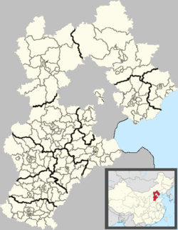 Yanjiao Location in Hebei | |
| Coordinates: 39°56′39″N 116°48′35″E / 39.9443°N 116.8098°ECoordinates: 39°56′39″N 116°48′35″E / 39.9443°N 116.8098°E | |
| Country | People's Republic of China |
| Province | Hebei |
| Prefecture-level city | Langfang |
| County-level city | Sanhe |
| Village-level divisions | 55 villages |
| Town establishment | March 1983 |
| Area | |
| • Total | 108.2 km2 (41.8 sq mi) |
| Dimensions | |
| • Length | 8.56 km (5.32 mi) |
| • Width | 7.28 km (4.52 mi) |
| Elevation | 28 m (93 ft) |
| Population | |
| • Total | 250,000 |
| • Density | 2,300/km2 (6,000/sq mi) |
| Time zone | UTC+8 (China Standard) |
| Postal code | 065201 |
| Area code(s) | 0316 |
Yanjiao (Chinese: 燕郊; pinyin: Yànjiāo; literally: "Yan suburbs") is a town under the administration of Sanhe City in central Hebei province,[1] bordering Tongzhou District, Beijing across the Chaobai River to the west, located 35 kilometres (22 mi) east of Tiananmen Square and 21 km (13 mi) west of Sanhe. It has a population of 250,000, with long-term residents accounting for 147,000 and migrants taking the rest; 97.9% of the population is of Han ethnicity.[2] As of 2011, it has 55 villages under its administration.[3]
History
The area was once located in the suburbs of the seat of the State of Yan of the Spring and Autumn period and Warring States period, hence the town's name. Before the establishment of the People's Republic, the area was administered by Tong County (present-day Tongzhou District), then in 1950 was ceded to Sanhe County; from 1958 to 1961, as part of the greater collectivisation of agriculture, was a part of Hongxing People's Commune (红星人民公社); 1962 saw Hongxing being split into three smaller communes, amongst them Yanjiao itself. Economic reforms led to the abolishing of the commune and the establishment of Yanjiao as a town in March 1983.[2]
Geography
Yanjiao is located in the extreme western end of Sanhe City and in the northwest of the Sanhe–Xianghe–Dachang exclave of Hebei. In addition to bordering Tongzhou District, Beijing to the west, it borders the town of Gaolou (高楼镇) to the north and Dachang Hui Autonomous County to the east and south. The town's north-south extent is 8.56 km (5.32 mi), and east-west width is 7.28 km (4.52 mi).[2]
Transport
.JPG)
China National Highway 102 provides access to nearby Tongzhou District as well as downtown Sanhe, while Beijing Capital International Airport is 35 kilometres (22 mi) away by road.
See also
References
- ↑ 2011年统计用区划代码和城乡划分代码:三河市 (in Chinese). National Bureau of Statistics of the People's Republic of China. Retrieved 2013-01-13.
- 1 2 3 燕郊镇简介 (in Chinese). Sanhe People's Government. Retrieved 2013-01-13.
- ↑ 2011年统计用区划代码和城乡划分代码:燕郊镇 (in Chinese). National Bureau of Statistics of the People's Republic of China. Retrieved 2013-01-13.