Yanajaja (Arequipa)
| Yanajaja | |
|---|---|
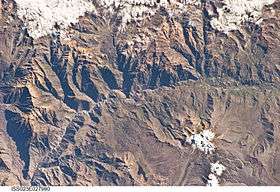 The Colca River and Yanajaja northwest of it (upper left) as seen from the ISS | |
| Highest point | |
| Elevation | 5,173 m (16,972 ft) |
| Coordinates | 15°27′55″S 72°11′40″W / 15.46528°S 72.19444°WCoordinates: 15°27′55″S 72°11′40″W / 15.46528°S 72.19444°W |
| Geography | |
 Yanajaja Peru | |
| Location | Peru, Arequipa Region |
| Parent range | Andes, Chila |
Yanajaja[1] (possibly from Quechua yana black, qaqa rock,[2] "black rock") is a 5,173-metre-high (16,972 ft) mountain in the west of the Chila mountain range in the Andes of Peru. It is located in the Arequipa Region, Castilla Province, Chachas District.[1] Yanajaja lies southwest of Cerani at a lake named Cochapunco.
References
This article is issued from
Wikipedia.
The text is licensed under Creative Commons - Attribution - Sharealike.
Additional terms may apply for the media files.