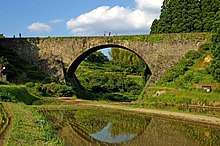
Yamato, Kumamoto
| Yamato 山都町 | |||
|---|---|---|---|
| Town | |||
| |||
 Location of Yamato in Kumamoto Prefecture | |||
 Yamato Location in Japan | |||
| Coordinates: 32°41′N 131°02′E / 32.683°N 131.033°ECoordinates: 32°41′N 131°02′E / 32.683°N 131.033°E | |||
| Country | Japan | ||
| Region | Kyushu | ||
| Prefecture | Kumamoto Prefecture | ||
| District | Kamimashiki | ||
| Area | |||
| • Total | 544.83 km2 (210.36 sq mi) | ||
| Population (February 28, 2017) | |||
| • Total | 15,771 | ||
| • Density | 29/km2 (75/sq mi) | ||
| Time zone | UTC+9 (JST) | ||
| Website |
www | ||


Yamato (山都町 Yamato-chō) is a town located in Kamimashiki District, Kumamoto Prefecture, Japan.
The town was formed on February 11, 2005 from the merger of the municipalities of Yabe and Seiwa with the town of Soyō from Aso District.
As of February 28, 2017, the town has an estimated population of 15,771[1] and a density of 29 persons per km². The total area is 544.83 km².
Famous people from Yamato
- Yasunosuke Futa - architect
- Yasuhiro Yamashita - judoka
- Tomiko Van - Japanese J-pop singer and occasional actress
References
- ↑ "Official website of Yamato Town" (in Japanese). Japan: Yamato Town. Retrieved 30 April 2017.
External links

- Yamato official website (in Japanese)
This article is issued from
Wikipedia.
The text is licensed under Creative Commons - Attribution - Sharealike.
Additional terms may apply for the media files.