Yako, Burkina Faso
| Yako | |
|---|---|
 Yako | |
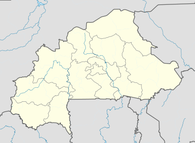 Yako Location within Burkina Faso | |
| Coordinates: 12°58′N 2°16′W / 12.967°N 2.267°W | |
| Country |
|
| Regions | Nord Region |
| Province | Passoré Province |
| Elevation | 301 m (988 ft) |
| Population (2012) | |
| • Total | 24,076 |
| Time zone | UTC+0 (GMT) |
Yako is a town in northern Burkina Faso, the capital of Passoré Province. It lies 109 kilometres (68 mi) north-west of Ouagadougou. Yako is known for its large mosque and as the birthplace of former President Thomas Sankara.
- Mosque in the centre of Yako
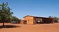 Bus station of Yako
Climate
Köppen-Geiger climate classification system classifies its climate as hot semi-arid (BSh).[1]
| Climate data for Yako | |||||||||||||
|---|---|---|---|---|---|---|---|---|---|---|---|---|---|
| Month | Jan | Feb | Mar | Apr | May | Jun | Jul | Aug | Sep | Oct | Nov | Dec | Year |
| Average high °C (°F) | 33.6 (92.5) |
36.2 (97.2) |
38.3 (100.9) |
38.7 (101.7) |
36.9 (98.4) |
34.1 (93.4) |
31.8 (89.2) |
30.7 (87.3) |
31.9 (89.4) |
35.2 (95.4) |
36.1 (97) |
33.8 (92.8) |
34.8 (94.6) |
| Daily mean °C (°F) | 25.4 (77.7) |
27.6 (81.7) |
30.5 (86.9) |
31.6 (88.9) |
30.6 (87.1) |
28.3 (82.9) |
26.8 (80.2) |
25.9 (78.6) |
26.6 (79.9) |
28.2 (82.8) |
27.7 (81.9) |
25.5 (77.9) |
27.9 (82.2) |
| Average low °C (°F) | 17.2 (63) |
19.1 (66.4) |
22.7 (72.9) |
24.6 (76.3) |
24.3 (75.7) |
22.6 (72.7) |
21 (70) |
21.2 (70.2) |
21.3 (70.3) |
21.2 (70.2) |
19.3 (66.7) |
17.2 (63) |
21 (69.8) |
| Average precipitation mm (inches) | 0 (0) |
0 (0) |
4 (0.16) |
16 (0.63) |
51 (2.01) |
93 (3.66) |
171 (6.73) |
191 (7.52) |
116 (4.57) |
24 (0.94) |
1 (0.04) |
1 (0.04) |
668 (26.3) |
| Source: Climate-Data.org (altitude: 333m)[1] | |||||||||||||
References
- 1 2 "Temperature, Climograph, Climate table for Yako". Climate-Data.org. Retrieved 2018-02-15.
This article is issued from
Wikipedia.
The text is licensed under Creative Commons - Attribution - Sharealike.
Additional terms may apply for the media files.