Yagba West
| Yagba West | |
|---|---|
| LGA | |
 Yagba West Location in Nigeria | |
| Coordinates: 8°15′N 5°33′E / 8.250°N 5.550°ECoordinates: 8°15′N 5°33′E / 8.250°N 5.550°E | |
| Country |
|
| State | Kogi State |
| Area | |
| • Total | 1,276 km2 (493 sq mi) |
| Population (2006 census) | |
| • Total | 149,023 |
| Time zone | UTC+1 (WAT) |
| 3-digit postal code prefix | 262 |
| ISO 3166 code | NG.KO.YW |
Yagba West is a Local Government Area in Kogi State, Nigeria, in the west of the state adjoining Kwara State. Its headquarters are in the town of Odo Ere.
It has an area of 1,276 km² and a population of 149,023 at the 2006 census. By 2016, the population grew to 188,900.[1]
The postal code of the area is 262.[2]
References
- ↑ "Kogi (State, Nigeria) - Population Statistics, Charts, Map and Location". www.citypopulation.de. Retrieved 2018-09-18.
- ↑ "Post Offices- with map of LGA". NIPOST. Retrieved 2009-10-20.
State capital: Lokoja | ||
| Local Government Areas | 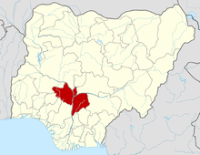 | |
This article is issued from
Wikipedia.
The text is licensed under Creative Commons - Attribution - Sharealike.
Additional terms may apply for the media files.