Y Foel Goch
| Y Foel Goch | |
|---|---|
 | |
| Highest point | |
| Elevation | 805 m (2,641 ft) |
| Prominence | 63 m (207 ft) |
| Parent peak | Glyder Fawr |
| Listing | Hewitt, Nuttall |
| Coordinates | 53°06′15″N 3°58′40″W / 53.1043°N 3.9779°WCoordinates: 53°06′15″N 3°58′40″W / 53.1043°N 3.9779°W |
| Naming | |
| Translation | red bold hill (Welsh) |
| Geography | |
| Location | Snowdonia, Wales |
| OS grid | SH677582 |
| Topo map | OS Landranger 115 |
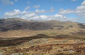
Y Foel Goch is a mountain in Snowdonia, north-west Wales, and is a sister peak along with Gallt yr Ogof to Glyder Fach. Between Glyder Fach and its summit lies Llyn Caseg-fraith, a popular lake for photographing Tryfan and its reflection.
The summit is grassy with a few small rock outcrops and is marked with a small cairn. The views are limited to the bulky neighbours of Moel Siabod, Tryfan and Glyder Fach. The ridge continues eastwards to Gallt yr Ogof.[1]
References
External links
This article is issued from
Wikipedia.
The text is licensed under Creative Commons - Attribution - Sharealike.
Additional terms may apply for the media files.