Xinyi Anhe MRT station
Xinyi Anhe R04 信義安和 | |
|---|---|
 | |
| Location |
Xinyi Rd., Sec. 4 Daan, Taipei Taiwan |
| Operated by | |
| Line(s) |
|
| Platforms | 2 (island platform) |
| Construction | |
| Structure type | Underground |
| Platform levels | 3 |
| History | |
| Opened | 24 November 2013 |
| Traffic | |
| Passengers |
31,281 daily (2016)[1] (Ranked 50th of 109) |
| Xinyi Anhe MRT station | |||||||||||
| Traditional Chinese | 信義安和站 | ||||||||||
|---|---|---|---|---|---|---|---|---|---|---|---|
| Simplified Chinese | 信义安和站 | ||||||||||
| |||||||||||
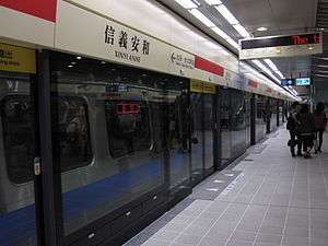
Taipei Metro Xinyi Anhe station is a station on the Red Line located beneath Xinyi Rd., Sec. 4 at the intersection of Xinyi Rd., Sec. 4 and Anhe Rd. in Daan District, Taipei, Taiwan.[2] The station was opened on 24 November 2013.[3]
History
Originally, the station was to be named "Anhe Road Station". The construction of the station began on July 2005. However, the Department of Rapid Transit Systems felt that the name was too broad. Thus, on 22 July 2011, it was announced that the station would be renamed to Xinyi Anhe station to more accurately describe the station location.[4]
The station is 210 m (690 ft) long and 30 m (98 ft) meters in wide. Excavation depth is at 22 m (72 ft) meters. It has five entrances, two elevators for the disabled and two vent shafts.[2] One of the entrances will be integrated into a joint development building.
Public Art
The design theme for the station is "Life melody - creation of a spatial atmosphere of a refined metropolitan lifestyle".
See also
| Wikimedia Commons has media related to Xinyi Anhe Station. |
| Preceding station | Following station | |||
|---|---|---|---|---|
| Daan | Tamsui–Xinyi line | Taipei 101 / World Trade Center towards Xiangshan | ||
References
- ↑ "Passenger Volume at Taipei Rapid Transit Stations" (PDF). Taipei City Department of Transportation. 2017-03-13. Retrieved 2017-03-13.
- 1 2 "捷運系統信義線簡介" (PDF). Department of Rapid Transit Systems, Taipei City Government. 2007-12-01. Retrieved 2010-06-18.
- ↑ "Second Stage of Taipei MRT (Approved MRT Lines)". Department of Rapid Transit Systems, TCG. 2010-03-12. Retrieved 2010-06-18.
- ↑ "臺北捷運4車站站名更名更具辨識性 以方便民眾搭乘". Department of Rapid Transit Systems. 2011-07-22. Retrieved 2011-07-23.
| Stations |
| ||||||
|---|---|---|---|---|---|---|---|
| Rolling stock |
| ||||||
Coordinates: 25°02′00″N 121°33′06″E / 25.0332°N 121.5516°E