Wotton-under-Edge
| Wotton-under-Edge | |
|---|---|
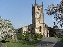 Church of St Mary the Virgin, Wotton-under-Edge | |
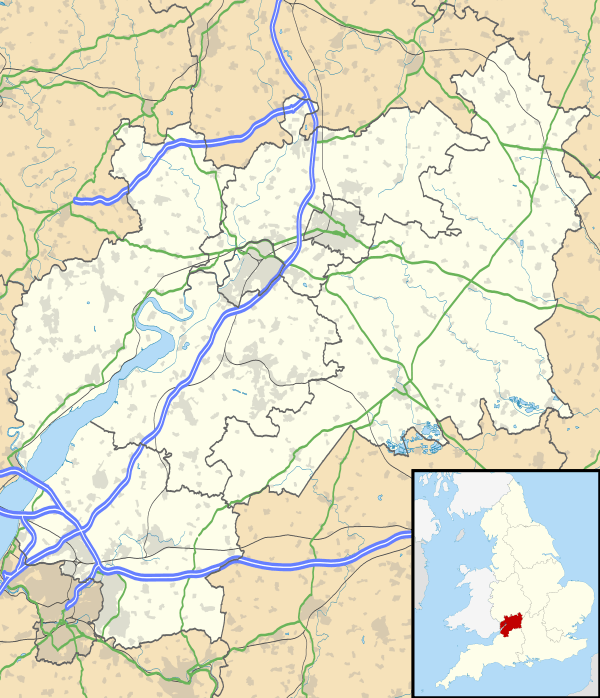 Wotton-under-Edge Wotton-under-Edge shown within Gloucestershire | |
| Population | 5,627 (2011 UK Census)[1] |
| OS grid reference | ST758933 |
| District | |
| Shire county | |
| Region | |
| Country | England |
| Sovereign state | United Kingdom |
| Post town | WOTTON-UNDER-EDGE |
| Postcode district | GL12 |
| Dialling code | 01453 |
| Police | Gloucestershire |
| Fire | Gloucestershire |
| Ambulance | South Western |
| EU Parliament | South West England |
| UK Parliament | |
Wotton-under-Edge /ˈwʊtən/ is a market town within the Stroud district of Gloucestershire, England. Located near the southern end of the Cotswolds, the Cotswold Way long-distance footpath passes through the town. Standing on the B4058 Wotton is about 5 miles (8.0 km) from the M5 motorway. The nearest railway station is Cam and Dursley, 7 miles (11 km) away by road, on the Bristol to Birmingham line.
History
The first record of the town is in an Anglo-Saxon Royal Charter of King Edmund I, who in AD 940 leased four hides of land in Wudetun to Eadric.[2] The name Wudetun means the enclosure, homestead or village (tun) in or near the wood (wude). The "Edge" refers to the limestone escarpment of the Cotswold Edge which includes the hills of Wotton Hill and Tor Hill that flank the town. In the 1086 Domesday Book listing, Wotton was in the hundred of Dudstone.[3]
Kingswood Abbey was founded in 1139,[4] but all that remains is a 16th-century Cistercian gatehouse. Nearby historical buildings include the Tudor houses of Newark Park and Owlpen Manor. The medieval former public house The Ancient Ram Inn dates back to 1145.[5]
The original town was burnt down during the reign of King John (1199-1216); it was rebuilt in 1252 and a charter granted to Johanna de Berkeley authorising her to hold a market and a three-day annual fair on the Feast of the Cross. In 1272 the inhabitants of the borough were authorised to elect one of their members as a Mayor, a practice that continued every year until 1886.[6][7]
St. Mary the Virgin was consecrated in 1283, and is the oldest and largest church in the town.
The Katharine Lady Berkeley's Grammar School was established in 1384 and is now a comprehensive named Katharine Lady Berkeley's School although the present modern building is a little outside of the town on the way to the village of Kingswood. The British School was established in the village in 1835.
A battle occurred near the Ancient Ram Inn in 1469, when the building was owned by a Viscount Lisle. William Berkely led the forces that beat the Viscount, and after the battle his men sacked the manor.
Overlooking the town on the top of Wotton Hill are a collection of trees planted in the 19th century to commemorate the Battle of Waterloo. These are situated on the site that housed one of the early warning beacons used to warn England of the approach of the Spanish Armada in 1588.
New Mills, founded in 1810, prospered by supplying both sides in the Napoleonic wars but after a century of decline the mill was near to closing in 1981 when it was acquired by Renishaw plc.[8]
The town's corporation status was abolished in 1886 following the Municipal Corporations Act of 1883
The Wotton-under-Edge BT Tower formed part of the microwave communication network.
Governance
An electoral ward with the same name exists. The ward mainly covers Wotton-under-Edge but also stretches to North Nibley. The total population of the ward taken at the 2011 census was 6,510.[9]
Facilities
The town is relatively well served for a town of its size, the town contains a Kebab, Pizza, Chinese and British Takeaways as well as an Indian restaurant/take-away, there are also three public houses, the town can be quite lively at night compared to many others of its size.
In 1958, local people and school students built the town swimming pool, which was completed in 1961. Subsequently the pool has had solar and electric heating installed. In 1999 with the fund raising support of community groups, a retractable enclosure was fitted to prolong the swimming season. [10]
In 2002, following the closure of the local cinema, a group of volunteers raised funds for a refurbishment to become one of the first digital cinemas in the UK. It re-opened in 2005 as a 100-seat facility inside an old stable yard, once part of the Crown Inn which closed in 1911. Films were first shown in the old Banqueting Hall of the Inn and moved to the stable yard some years later, due to the popularity of films. The Wotton Electric Picture House (the original name) is now a thriving venue[11]
The town has always lacked a railway station. There was once one at nearby Charfield, which is still on a partly-extant line, and there have been calls for the station to be re-opened.
Gallery
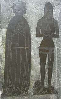 Monumental brass of Thomas de Berkeley, 5th Baron Berkeley (d.1417), Church of St Mary the Virgin
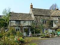 The Ancient Ram Inn
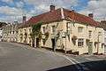 The Falcon Inn
 The Tolsey clock commemorates the Diamond Jubilee (60 years) of Queen Victoria's reign. The clock says "1837 - 1897". It lies between Market Street and High Street.
Notable people
- More Adey (1858–1942) – art critic[12]
- Ian Alexander – footballer
- Thomas de Berkeley, 5th Baron Berkeley (d.1417)
- John Biddle – Unitarian
- Charles Blagden – physician
- U. A. Fanthorpe – poet
- Sir Matthew Hale – Lord Chief Justice (1671–1676)
- Matthew Blagden Hale – bishop
- Evan Hayward – Member of Parliament
- Mark Horton – archaeologist
- Catherine Johnson – playwright
- Richard Knill – missionary
- Ian MacDonald (1948–2003) – music critic and author[13]
- Sir Isaac Pitman – creator of Pitman Shorthand, Pitman Place is named after him
- Mark Porter – doctor
- Sean Rigg – footballer
- Jamie Stephens – footballer
Further reading
- E.S. Lindley. Wotton under Edge: Men and Affairs of a Cotswold Wool Town. Published by Museum Press, 1962
- Simon Herrick. Under the Hill. (1979). ISBN 0-904387-36-4
References
- ↑ "Parish population 2011". Retrieved 31 March 2015.
- ↑ "Archived copy". Archived from the original on 2 April 2012. Retrieved 16 September 2011.
- ↑ http://opendomesday.org/place/SO8520/wotton/ Open Domesday: Wotton
- ↑ Kingswood Abbey Deeds
- ↑ "Stroud District Council" (PDF). Archived from the original (PDF) on 27 September 2012. Retrieved 14 March 2013.
- ↑ Wright, William Horace (1872). Historical Notes Relating to the Borough of Wotton,, And a List of Mayors of the Borough from 1660.
- ↑ Rudge, Thomas (1803). The history of the county of Gloucester. p. 249.
- ↑ The Wotton World Beater Management Today
- ↑ "Ward population 2011". Retrieved 31 March 2015.
- ↑ Wotton Swimming Pool Ltd. "Wotton Pool". Wotton Pool. Archived from the original on 15 August 2010. Retrieved 14 March 2013.
- ↑ "Wotton Electric Picture House welcomes 50,000th visitor". Thisisbristol.co.uk. 5 January 2013. Retrieved 14 March 2013.
- ↑ Sorensen, Lee. "Adey, More". Dictionary of Art Historians. Retrieved 3 July 2018.
- ↑ Williams, Richard (8 September 2003). "Obituary: Ian MacDonald". The Guardian. London. Retrieved 3 July 2018.
External links
| Wikimedia Commons has media related to Wotton-under-Edge. |
| Wikivoyage has a travel guide for Wotton-under-Edge. |
- Official website
- BBC archive film of Wotton-under-Edge from 1977
- Wotton-under-Edge at Curlie (based on DMOZ)
- Electric Picture House Cinema
- Wotton-under-Edge Swimming Pool
- Local Garage
- Stroud Voices (Wotton-under-Edge filter) - oral history site
- Ordnance Survey Bench Marks (Wotton-under-Edge page) - height above sea level markers
| Following the Cotswold Way | |
|---|---|
| Towards Bath | Towards Chipping Campden |
| 20 km (12 miles) to Old Sodbury | 11 km (7 miles) to Dursley |