Winterbach, Bad Kreuznach
| Winterbach | ||
|---|---|---|
| ||
 Winterbach Location of Winterbach within Bad Kreuznach district 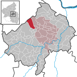 | ||
| Coordinates: 49°52′31.69″N 7°38′10.55″E / 49.8754694°N 7.6362639°ECoordinates: 49°52′31.69″N 7°38′10.55″E / 49.8754694°N 7.6362639°E | ||
| Country | Germany | |
| State | Rhineland-Palatinate | |
| District | Bad Kreuznach | |
| Municipal assoc. | Rüdesheim | |
| Government | ||
| • Mayor | Horst Eiler | |
| Area | ||
| • Total | 14.49 km2 (5.59 sq mi) | |
| Elevation | 355 m (1,165 ft) | |
| Population (2017-12-31)[1] | ||
| • Total | 485 | |
| • Density | 33/km2 (87/sq mi) | |
| Time zone | CET/CEST (UTC+1/+2) | |
| Postal codes | 55595 | |
| Dialling codes | 06756 | |
| Vehicle registration | KH | |
| Website | winterbachsoonwald.de | |

Winterbach is a municipality in the district of Bad Kreuznach in Rhineland-Palatinate, in western Germany. It belongs to the Rüdesheim association. Winterbach is also a state-approved resort.[2]
Geography
Winterbach is located in the southern Hunsrück, on the edge of the Soonwald at the 657 meter high Ellerspring. With 77.1 percent of the land area being wooded. The Ellerbach also flows through the village. Winterbach also includes the residences of Forsthaus Winterbach, Kreershäuschen and Kuhpferch.[3]
References
- ↑ Statistisches Landesamt Rheinland-Pfalz "Bevölkerungsstand 2017 - Gemeindeebene" Check
|url=value (help). Statistisches Landesamt Rheinland-Pfalz (in German). 2018. - ↑ Rheinland-Pfalz, Staatskanzlei. "Mein Dorf, meine Stadt (Template)". Statistisches Landesamt Rheinland-Pfalz. Retrieved 2017-10-26.
- ↑ "Statistisches Landesamt Rheinland-Pfalz - Official Directory of Municipalities and Municipalities 2010 , page 16 (PDF, 2,3 MB)" (PDF). Archived from the original (PDF) on 2015-11-25.
This article is issued from
Wikipedia.
The text is licensed under Creative Commons - Attribution - Sharealike.
Additional terms may apply for the media files.