Winnipeg Route 42
 | |
|---|---|
 | |
| Other name(s) | Pembina Hwy / Donald St / Smith St / Princess St / King St / Disraeli Fwy / Henderson Hwy |
| Maintained by | City of Winnipeg |
| Length | 27 km (17 mi) |
| Location | Winnipeg, Manitoba |
| South end | PTH 75 south / Turnbull Dr east |
| Major junctions |
PTH 100 (TCH) (Perimeter Hwy) Route 165 (Bishop Grandin Blvd) Route 155 west (McGillivray Blvd) Route 125 east (Jubilee Ave) Route 70 north (Stafford St) Route 105 west (Grant Ave) Route 62 / Route 95 west PTH 1 (TCH) / Broadway Route 85 / Route 57 east (Portage Ave) Route 57 west (Notre Dame Ave) Route 52 (Main St) Route 47 west (Logan Ave) Route 37 (Hespeler Ave / Johnson Ave W) Route 17 (Chief Peguis Tr) |
| North end | PTH 101 (Perimeter Hwy) / PR 204 north |
| Other | |
| Known for |
Confusion Corner Investors Group Field access University of Manitoba access |
Route 42 is a major arterial road located in Winnipeg, Manitoba. It connects the suburbs of North Kildonan, East Kildonan, Fort Rouge, Fort Garry, and St. Norbert with the city's downtown core. In the north, it is a continuation of Manitoba Provincial Road 204; in the south, it is a continuation of PTH 75, also known as the Lord Selkirk Highway.
Route description
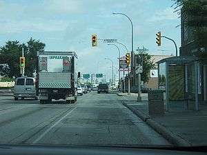
The route begins at PTH 75 and Turbell Drive in the suburb of St. Norbert and, as Pembina Highway, crosses the Perimeter Highway South, and runs north-northwest through Fort Garry (passing by the University of Manitoba). At Confusion Corner, it takes the name Donald Street until it crosses the Assiniboine River at the Midtown Bridge, and splits into one-way streets where southbound traffic continues along Donald Street and northbound traffic follows Smith Street. At Notre Dame Avenue, it becomes King Street (northbound) and Princess Street (southbound) until it crosses Main Street and becomes the Disraeli Freeway, continuing northeast, passing through the neighbourhood of Point Douglas and crosses the Red River at the Disraeli Bridge, where it becomes Henderson Highway. Running north along the east bank of the Red River, it passes Hespeler Avenue and Chief Peguis Trail to Perimeter Highway North where it leaves the city as Provincial Road 204.
History
The namesakes of the various roads making up Route 42 are as follows:
- Pembina Highway, together with PTH 75, originated as a trail used by early settlers to travel between the Selkirk Settlement and Fort Pembina.[1]
- Donald Street and Smith Street are named for the 1st Lord Strathcona.[2]
- King Street is named for John Mark King, a local clergyman.[2]
- Princess Street is named for Princess Louise, Duchess of Argyll.[2]
- Disraeli Freeway is named for Benjamin Disraeli.[2]
- Henderson Highway is named for early Manitoba pioneer Samuel Robert Henderson[2]
Major intersections
| Street Name | Location | km[3] | mi | Destinations | Notes | ||
|---|---|---|---|---|---|---|---|
| Continues as | |||||||
| Pembina Highway | St. Norbert | 0.0 | 0.0 | Turnbull Drive | South end of PTH 75 concurrency; Route 42 southern terminus | ||
| Fort Garry | 2.8 | 1.7 | Grade separated; south end of PTH 75 concurrency; signed as exits 94A (east) and 94B (west); PTH 100 exit 18 | ||||
| 3.3 | 2.1 | Bairdmore Boulevard / Dalhousie Drive | |||||
| 4.7 | 2.9 | Bairdmore Boulevard / Dalhousie Drive | |||||
| 5.5 | 3.4 | Bison Drive / Chancellor Matheson Road – University of Manitoba, Investors Group Field | |||||
| 7.4 | 4.6 | University Crescent – University of Manitoba | |||||
| 7.5 | 4.7 | Grade separated | |||||
| 10.0 | 6.2 | ||||||
| 11.3 | 7.0 | Grade separated | |||||
| Fort Rouge | 11.7 | 7.3 | |||||
| 12.0 | 7.5 | Taylor Avenue | |||||
| 12.7 | 7.9 | ||||||
| 13.9 | 8.6 | Confusion Corner | |||||
| Donald Street | Pembina Highway north end • Donald Street south end | ||||||
| 14.6 | 9.1 | Stradbrook Avenue | One-way, eastbound | ||||
| 14.9 | 9.3 | River Avenue | One-way, westbound | ||||
| Assiniboine River | 15.1 | 9.4 | Midtown Bridge Smith Street south end (one-way transition) | ||||
| Smith Street (northbound) Donald Street (northbound) | Downtown | 15.5 | 9.6 | ||||
| 15.7 | 9.8 | York Avenue | One-way, eastbound | ||||
| 15.9 | 9.9 | St. Mary Avenue | One-way, westbound | ||||
| 16.1 | 10.0 | Graham Avenue | Transit only | ||||
| 16.3 | 10.1 | ||||||
| 16.4 | 10.2 | Ellice Avenue | |||||
| 16.5 | 10.3 | Cumberland Avenue | One-way, eastbound (no access); southbound entrance only | ||||
| 16.55 | 10.28 | Smith Street, King Street | Route 42 north branches north onto King Street | ||||
| Smith Street north end • King Street south end (northbound) | |||||||
| King Street (northbound) Princess Street (southbound) | 16.6 | 10.3 | One-way, westbound | ||||
| Donald Street north end • Princess Street south end (southbound) | |||||||
| 16.9 | 10.5 | William Avenue | |||||
| James Avenue (northbound) Princess Street (southbound) | 17.1 | 10.6 | James Avenue, King Street | One-way, eastbound; Route 42 north branches east onto James Avenue | |||
| Main Street (northbound) Princess Street (southbound) | 17.2 | 10.7 | Route 42 north branches north onto Main Street; south end of Route 42 north / Route 52 north concurrency | ||||
| Main Street (northbound) Alexander Avenue (southbound) | 17.3 | 10.7 | Alexander Avenue, Princess Street | Route 42 south branches south onto Princess Street | |||
| Disraeli Freeway | 17.4 | 10.8 | Route 42 south branches south onto Princess Street | ||||
| Alexander Avenue east end (one-way transition) • Disraeli Freeway south end (two-way traffic) | |||||||
| 17.6 | 10.9 | ||||||
| 18.5 | 11.5 | Sutherland Avenue | Grade separated | ||||
| Red River | 18.8 | 11.7 | Disraeli Bridge Disraeli Freeway north end • Henderson Highway south end | ||||
| Henderson Highway | East Kildonan | 19.0 | 11.8 | Grade separated; south end of Route 37 east concurrency; signed as Talbot Avenue (northbound) and Midwinter Avenue (southbound) | |||
| 19.4 | 12.1 | North end of Route 37 east concurrency; south end of Route 37 west concurrency | |||||
| 19.6 | 12.2 | North end of Route 37 west concurrency | |||||
| 20.5 | 12.7 | Munroe Avenue | |||||
| 22.6 | 14.0 | McLeod Avenue | |||||
| North Kildonan | 23.9 | 14.9 | |||||
| 24.9 | 15.5 | McIvor Avenue | |||||
| 25.9 | 16.1 | Glenway Avenue | Winnipeg city limits | ||||
| R.M. East St. Paul | 26.7 | 16.6 | Grade separated; exit 72 on PTH 101; Route 42 northern terminus | ||||
| Continues as | |||||||
1.000 mi = 1.609 km; 1.000 km = 0.621 mi
| |||||||
References
Route map:
- ↑ The Lord Selkirk Settlement at Red River, Part 3
- 1 2 3 4 5 History in Winnipeg Street Names from the Manitoba Historical Society.
- ↑ Google (August 1, 2017). "Route 42 in Winnipeg, Manitoba" (Map). Google Maps. Google. Retrieved August 1, 2017.