Wind River (Yukon)
| Wind River | |
| Country | Canada |
|---|---|
| State | Yukon |
| Mouth | Peel River |
| - elevation | 647 ft (197 m) [1] |
| - coordinates | 65°50′29″N 135°18′26″W / 65.84139°N 135.30722°WCoordinates: 65°50′29″N 135°18′26″W / 65.84139°N 135.30722°W [2] |
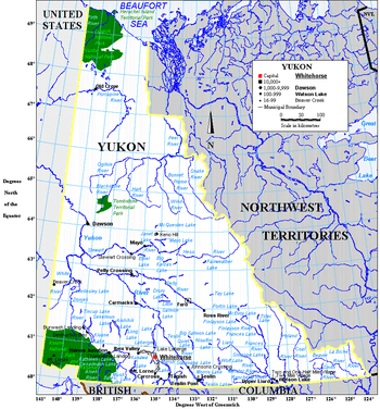 Wind River is northeast of Dawson City | |
The Wind River is a river in Yukon, part of the Peel River watershed. It lies to the west of the Bonnet Plume and Snake Rivers.
The river is only accessible by air, or by trekking overland, or along a winter road. The river is paddled several times a year by various groups.[3] The river is made up of long sets of Class I and Class II rapids, with virtually no flat water. In some parts the channel is very wide and braided, and occasionally very shallow. For paddling, the river is not too technical, but it does have long stretches of Class II rapids and areas where lining is required. Some paddling experience is a definite asset; several companies offer guided trips down the Wind River.[4]
See also
References
- ↑ Mouth elevation derived from Google Earth using Geographical Names Data Base mouth coordinates.
- ↑ "Wind River". Geographical Names Data Base. Natural Resources Canada. Retrieved January 31, 2013.
- ↑ "The Heart of the Yukon". Ruby Range Adventure. 2014. Retrieved 23 January 2014.
- ↑ "About the Wind River Wilderness Area". Cabin Fever Adventures. 2014. Retrieved 23 January 2014.
This article is issued from
Wikipedia.
The text is licensed under Creative Commons - Attribution - Sharealike.
Additional terms may apply for the media files.