Wiesent (Danube)
| Wiesent | |
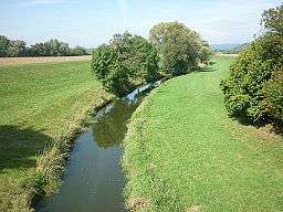 The Wiesent in Wörth an der Donau municipality | |
| Country | Germany |
|---|---|
| State | Bavaria |
| Region | Upper Palatinate |
| District | Regensburg |
| Tributaries | |
| - left | Perlbach, Wörther Bach, Rupertsbühler Bach |
| - right | Deßgraben, Augraben |
| Source | Falkensteiner Vorwald (young-growth forest) |
| - location | near Wiesenfelden |
| - elevation | 652 m (2,139 ft) |
| - coordinates | 49°03′06″N 12°34′41″E / 49.05167°N 12.57806°E |
| Mouth | Danube |
| - location | Alte Donau oxbow |
| - elevation | 320 m (1,050 ft) |
| - coordinates | 48°58′11″N 12°26′16″E / 48.96972°N 12.43778°ECoordinates: 48°58′11″N 12°26′16″E / 48.96972°N 12.43778°E |
| Length | 40.0[1] km (25 mi) |
| Basin | 156[1] km2 (60 sq mi) |
| Progression | Danube→ Black Sea |
Wiesent is a river of Bavaria, Germany.[2] It is a tributary of the Danube, that it enters through the oxbow Alte Donau between Wörth an der Donau and Niederachdorf.[2]
See also
Notes and references
- 1 2 Complete table of the Bavarian Waterbody Register by the Bavarian State Office for the Environment (xls, 10.3 MB)
- 1 2 "BayernAtlas". Bavarian State Government.
This article is issued from
Wikipedia.
The text is licensed under Creative Commons - Attribution - Sharealike.
Additional terms may apply for the media files.