Wielen
| Wielen | |
|---|---|
 Wielen Location of Wielen within Grafschaft Bentheim district 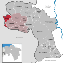  | |
| Coordinates: 52°33′N 6°43′E / 52.550°N 6.717°ECoordinates: 52°33′N 6°43′E / 52.550°N 6.717°E | |
| Country | Germany |
| State | Lower Saxony |
| District | Grafschaft Bentheim |
| Municipal assoc. | Uelsen |
| Government | |
| • Mayor | Gerold Stroeve |
| Area | |
| • Total | 23.06 km2 (8.90 sq mi) |
| Elevation | 20 m (70 ft) |
| Population (2017-12-31)[1] | |
| • Total | 522 |
| • Density | 23/km2 (59/sq mi) |
| Time zone | CET/CEST (UTC+1/+2) |
| Postal codes | 49847 |
| Dialling codes | 0 59 48 |
| Vehicle registration | NOH |
| Website |
www.uelsen.de/samtgem/ fwielen.HTML |
Wielen is a small village in the district of Grafschaft Bentheim in Lower Saxony, Germany, and belongs to the Joint Community (Samtgemeinde) of Uelsen. Wielen has 614 inhabitants. Within the village is found the Lower County’s oldest maintained school, het Schöltien.
Constituent communities
Along with the namesake Ortsteil, there are outlying centres named Balderhaar, Striepe and Vennebrügge.
References
External links
Towns and municipalities in Grafschaft Bentheim (district) | ||
|---|---|---|
This article is issued from
Wikipedia.
The text is licensed under Creative Commons - Attribution - Sharealike.
Additional terms may apply for the media files.