Whiteville, Louisiana
| Whiteville | |
|---|---|
| Unincorporated community | |
 Whiteville Location within the state of Louisiana | |
| Coordinates: 30°47′18″N 92°8′51″W / 30.78833°N 92.14750°WCoordinates: 30°47′18″N 92°8′51″W / 30.78833°N 92.14750°W | |
| Country | United States |
| State | Louisiana |
| Parish | St. Landry |
| Time zone | UTC-6 (Central (CST)) |
| • Summer (DST) | UTC-5 (CDT) |
| GNIS feature ID | 1628499[1] |
Whiteville is an unincorporated community in St. Landry Parish, Louisiana, United States. It is located approximately 20 miles north of Opelousas along Louisiana Highway 29.
The community is part of the Opelousas–Eunice Micropolitan Statistical Area.
References
Municipalities and communities of St. Landry Parish, Louisiana, United States | ||
|---|---|---|
| Cities | 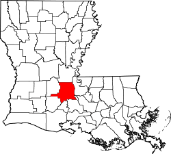 | |
| Towns | ||
| Villages | ||
| CDP | ||
| Other unincorporated communities |
| |
| Footnotes | ‡This populated place also has portions in an adjacent parish or parishes | |
This article is issued from
Wikipedia.
The text is licensed under Creative Commons - Attribution - Sharealike.
Additional terms may apply for the media files.