White Horse Tavern (Boston, Massachusetts)
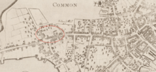
The White Horse was a tavern in Boston, Massachusetts, in the 17th and 18th centuries. A well-known gathering place in colonial Boston, it "had a large square sign projecting over the footway, on which was delineated a white charger."[1] Located near Boylston Street, the White Horse was frequently mentioned as a wayfinder to other establishments nearby.
A number of taverns were clustered on old Newbury Street in the 18th century: Lamb Tavern, Liberty Tavern, and Red Lion.[2] For at least some years of its existence, possibly around 1798, the White Horse building "was of wood and of two stories,"[3] with 26 windows.[4]
Prior to 1700, the White Horse was owned by the William Colburn (aka William Colburne) family.[4] Under the ownership of Thomas Brattle (1700-ca.1740), the tavern was managed by Thomas Chamberlain (licensed in 1717), and William Cleeres (licensed in 1718). After Brattle, the tavern was owned by Jonathan Dwight (1740-ca.1765?). Managers included Mrs. Moulton (licensed in 1764). The next owner was Joseph Morton (1765–1791). In May, 1787, Israel Hatch of Attleboro took over as manager of the tavern.[5] Subsequent owners included Joseph Morton's son, Perez Morton (1791-ca.1798); and Aaron Emmes (1798).[6]
The White Horse is featured in a scene in the novel The Rebels: Or, Boston Before the Revolution by Lydia Maria Child (1850).
References
- ↑ Samuel Adams Drake (1873), Old landmarks and historic personages of Boston, Boston: James R. Osgood and Co., OCLC 3012180
- ↑ Edwin M. Bacon (1913), Washington Street, old and new: A History in Narrative Form of the Changes which this Ancient Street Has Undergone Since the Settlement of Boston, Boston: Macullar Parker Co., OCLC 6607720
- ↑ Bostonian Society. The old town-house of Boston. 1892; p.23
- 1 2 Samuel Adams Drake (1917), Old Boston taverns and tavern clubs (New illustrated ed.), Boston: W. A. Butterfield
- ↑ Frederic James Wood. The turnpikes of New England and evolution of the same through England, Virginia, and Maryland. Marshall Jones company, 1919; p.88.
- ↑ Drake. 1917; p.23. Repeated in: Annie Haven Thwing (1920), The crooked & narrow streets of the town of Boston, 1630-1822, Boston: Marshall Jones Company, OCLC 526147