Westermarsch II
| Westermarsch II | ||
|---|---|---|
| Stadtteil of Norden | ||
| ||
 Westermarsch II Lage von Westermarsch II im Stadtgebiet von Norden 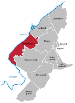 | ||
| Coordinates: 53°35′35″N 07°07′35″E / 53.59306°N 7.12639°ECoordinates: 53°35′35″N 07°07′35″E / 53.59306°N 7.12639°E | ||
| Country | Germany | |
| State | Lower Saxony | |
| Town | Norden | |
| Area | ||
| • Total | 11.687 km2 (4.512 sq mi) | |
| Elevation | 1 m (3 ft) | |
| Population (2016-12-31) | ||
| • Total | 507 | |
| • Density | 43/km2 (110/sq mi) | |
| Time zone | CET/CEST (UTC+1/+2) | |
| Dialling codes | 04931 | |

Westermarsch II was an independent municipality until the 1972 territorial reform in Lower Saxony and, as such, a member of the collective municipality (Samtgemeinde) of Leybucht in Lower Saxony. Today Westermarsch II is a village in the East Frisian borough of Norden with around 500 inhabitants (as at 12/2016).[1] The village parish covers an area of 11.69 km².[2] Curiously the main settlement of Westermarsch II is associated in public perception with the village of Norddeich, with which it has grown together. The boundary between the two runs down the middle of the road, Dörper Weg.
Name
The name Westermarsch II denotes the place as being in the west of the marshlands in the historical region of Norderland (see Ostermarsch). The Roman numeral in the name of the village distinguishes the former communal municipality (Kommunalgemeinde) from its the neighbouring village of Westermarsch I.
History
The exact date that the village was founded is unknown. Even before the land was dyked, people settled in the area on artificial hills, the so-called warfts, of which several have survived at least in place names like Osterwarf, Westerwarf, Waterwarf, Trumschlag, Ülkebült, Klooster and Kugel. They are estimated to be about 1,000 to 1,500 years old. In 1361 the region was first known as Westermarsch after being dyked in. In 1871 the region was divided into Westermarsch I & II.
On 1 July 1972 the municipality of Westermarsch II was incorporated into the borough of Norden.[3] The village has been designated since 2010 as a North Sea health spa (Nordseeheilbad).[4]
References
- ↑ Norden.de: Einwohnerzahl nach Ortsteilen
- ↑ Norden.de: Ortsteile der Stadt Norden
- ↑ Statistisches Bundesamt, ed. (1983) (in German), Historisches Gemeindeverzeichnis für die Bundesrepublik Deutschland. Namens-, Grenz- und Schlüsselnummernänderungen bei Gemeinden, Kreisen und Regierungsbezirken vom 27. 5. 1970 bis 31. 12. 1982, Stuttgart/Mainz: W. Kohlhammer GmbH, p. 264, ISBN 3-17-003263-1
- ↑ Ostfriesischer Kurier dated 25 June 2010, pages 1, 3.
The borough of Norden | ||
|---|---|---|
| Old divisions | ||
| New divisions after the regional reform |
| |