Westerfield
| Westerfield | |
|---|---|
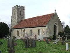 Westerfield, Church of St Mary Magdalene | |
 Westerfield Westerfield shown within Suffolk | |
| Population | 442 (2011) |
| District | |
| Shire county | |
| Region | |
| Country | England |
| Sovereign state | United Kingdom |
| Post town | IPSWICH |
| Postcode district | IP6 |
| Dialling code | 01473 |
| EU Parliament | East of England |
Westerfield is a village in Suffolk, England.[1] It is located approximately two miles north of the centre of Ipswich. The village is served by Westerfield railway station on the Ipswich-Lowestoft East Suffolk Line.
Westerfield has two public houses, The Swan in northern Westerfield, and The Railway in the south of the village. Both serve food and are significant in bringing the community together. In central Westerfield is the village green, which is part of the church grounds.
The population of Westerfield currently stands at around 200, including Culpho and measured at 442 in the 2011 Census.[2]
References
- ↑ Ordnance Survey: Landranger map sheet 169 Ipswich & The Naze (Clacton-on-Sea) (Map). Ordnance Survey. 2014. ISBN 9780319229231.
- ↑ "Parish population 2011". Retrieved 18 September 2015.
External links
| Wikimedia Commons has media related to Westerfield. |
This article is issued from
Wikipedia.
The text is licensed under Creative Commons - Attribution - Sharealike.
Additional terms may apply for the media files.