West Point Light (New York)
_Lighthouse.JPG) Light #39 on Gee's Point | |
 | |
| Location | New York, US |
|---|---|
| Coordinates | 41°23′45″N 73°57′3″W / 41.39583°N 73.95083°WCoordinates: 41°23′45″N 73°57′3″W / 41.39583°N 73.95083°W |
| Year first constructed | 1853 |
| Deactivated | 1946 |
| Construction | Wooden |
| Tower shape | Square |
| Markings / pattern | White |
| Focal height | 40 ft (12 m) |
| Original lens | Sixth order Fresnel lens |
| Characteristic | Fixed white |
| ARLHS number | USA-879 [1] |
West Point Light was a lighthouse at the United States Military Academy in West Point, New York. It was located at Gee's Point and was sometimes referred to as Gee's Point Light.
West Point Light would be shown on the NOAA Chart 12343[2] if it were still active. Today, Light 39 (USCG 1-38005),[3] on a skeleton tower with a fixed green light characteristic, has replaced West Point Light on Gee's Point.
History
West Point, 45 miles (72 km) above the Battery, is the site of the United States Military Academy. The northeastern extremity of West Point descends to a rocky point, upon the extremity of which was West Point lighthouse. On the opposite side of the river and north of West Point is Constitution Island; the bend between the two is locally known as Worlds End, and has very deep water of 36 fathoms (216 ft; 66 m).
A little above Constitution Island, on the west bank of the river, is a steep, rocky, wooded hill 1,396 feet (426 m) high, known as Crow's Nest, and just above it is a prominent hill 1,340 feet (410 m) high known as Storm King Mountain.[4]
West Point is a high, bluff thickly wooded point, almost entirely occupied by the grounds and buildings of the United States Military Academy. On the northeast it descends to a bare rocky point, upon the extremity of which stood a low square wooden tower, painted white. This was West Point Lighthouse.[5]
Cultural
The Archives Center at the Smithsonian National Museum of American History has a collection (#1055) of souvenir postcards of lighthouses and has digitized 272 of these and made them available online. These include postcards of West Point Light (New York) [6] with links to customized nautical charts provided by the National Oceanographic and Atmospheric Administration.
References
- ↑ ARLHS World List of Lights
- ↑ NOAA Chart 12343
- ↑ Light List, Volume I, Atlantic Coast, St. Croix River, Maine to Shrewsbury River, New Jersey (PDF). Light List. United States Coast Guard.
- ↑ United States Coast Pilot, Atlantic Coast, Section B, Cape Cod to Sandy Hook, 1918, pg 287
- ↑ United States Atlantic Coast Pilot, Boston Bay to New York, 1878, pg 568
- ↑ Smithsonian lighthouse postcards
External links
- Lighthouse Friends site
- "Historic Light Station Information and Photography: New York". United States Coast Guard Historian's Office.
- Rowlett, Russ. "Lighthouses of the United States: Downstate New York". The Lighthouse Directory. University of North Carolina at Chapel Hill.
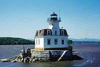
Lighthouses of the Hudson River | ||
|---|---|---|
|  | |
| Academics |  | |
|---|---|---|
| Athletics | ||
| Campus | ||
| History | ||
| People | ||
| Traditions | ||
| Lore | ||