West Jensen Island
| Vest Jensens Ø | |
|---|---|
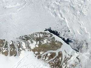 Satellite image of the northern end of Greenland | |
 West Jensen Island West Jensen Island (Greenland) | |
| Geography | |
| Location | Lincoln Sea |
| Coordinates | 83°2′N 41°23′W / 83.033°N 41.383°WCoordinates: 83°2′N 41°23′W / 83.033°N 41.383°W |
| Area | 161.4 km2 (62.3 sq mi) |
| Length | 30 km (19 mi) |
| Width | 7 km (4.3 mi) |
| Coastline | 68.2 km (42.38 mi) |
| Highest elevation | 944.88 m (3,100 ft) |
| Administration | |
| Zone | Northeast Greenland National Park |
| Demographics | |
| Population | 0 |
West Jensen Island (Danish: Vest Jensens Ø) is an uninhabited island of the Lincoln Sea in Peary Land, far northern Greenland.
Geography
It is a long island off the western side of the Nansen Land Peninsula on the other side of the Thomas Thomsen Fjord. Its eastern shore forms the western side of Adolf Jensen Fjord, beyond which lies slightly larger East Jensen Island. Smaller Hanne Island lies 3 km to the north.[1] East Jensen Island has an area of 161.4 km2 (62.3 sq mi) and a shoreline of 68.2 km (42.4 mi).[2]
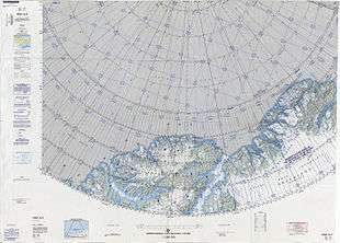 Map of Northern Ellesmere Island and far Northern Greenland. |
See also
References
This article is issued from
Wikipedia.
The text is licensed under Creative Commons - Attribution - Sharealike.
Additional terms may apply for the media files.