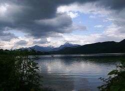
Weißensee (Füssen)
| Weißensee | |
|---|---|
 | |
| Location | Allgäu, Bavaria |
| Coordinates | 47°34′14″N 10°38′12″E / 47.57056°N 10.63667°ECoordinates: 47°34′14″N 10°38′12″E / 47.57056°N 10.63667°E |
| Primary inflows | Bergbach (Westen) |
| Primary outflows | Füssener Achen (Osten) |
| Catchment area | 15 km2 (5.8 sq mi) |
| Basin countries | Germany |
| Max. length | 2.31 km (1.44 mi) |
| Max. width | 0.86 km (0.53 mi) |
| Surface area | 134.65 ha (332.7 acres) |
| Average depth | 12.2 m (40 ft) |
| Max. depth | 24.7 m (81 ft) |
| Water volume | 16,520,000 m3 (583,000,000 cu ft) |
| Shore length1 | 6.1 km (3.8 mi) |
| Surface elevation | 787.3 m (2,583 ft) |
| 1 Shore length is not a well-defined measure. | |
Weißensee (Füssen) is a lake in Allgäu, Bavaria, Germany. At an elevation of 787.3 m, its surface area is 134.65 ha.
External links
- Nixdorf, B.; et al. (2004), "Weißensee (Füssen)", Dokumentation von Zustand und Entwicklung der wichtigsten Seen Deutschlands (in German), Berlin: Umweltbundesamt, p. 96
- Weissensee, Article
This article is issued from
Wikipedia.
The text is licensed under Creative Commons - Attribution - Sharealike.
Additional terms may apply for the media files.