Webberville, Texas
| Webberville, Texas | |
|---|---|
| Village | |
 | |
| Coordinates: 30°13′34″N 97°29′59″W / 30.22611°N 97.49972°W | |
| Country | United States |
| State | Texas |
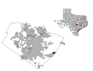
| County | Travis |
| Area | |
| • Total | 2.1 sq mi (5.4 km2) |
| • Land | 2.1 sq mi (5.4 km2) |
| • Water | 0.0 sq mi (0.0 km2) |
| Elevation | 817 ft (249 m) |
| Population (2010) | |
| • Total | 392 |
| • Density | 190/sq mi (73/km2) |
| Time zone | UTC-6 (Central (CST)) |
| • Summer (DST) | UTC-5 (CDT) |
| Zip Code | 78621, 78653 |
| Website | Webberville Village Commission |
Webberville is a village in Travis County, Texas (USA). Its population was 392, according to a 2010 census estimate.[1]
Comprising settlements dating back to 1827, Webber's Prairie was formally established by retired physician John Ferdinand Webber in 1839. Webber's Prairie was renamed Webberville in 1853, and was incorporated as a Village in February 2003.[2]
In December 2011, the new Webberville Solar Farm began generating solar energy with Gemini Solar Development Company for Austin Energy. In 2009, the two companies signed a 25-year contract. The solar farm is expected to generate 30 megawatts annually which will provide electricity for about 5000 households.[3]
Geography
Webberville is located at 30°13′34″N 97°29′59″W / 30.22611°N 97.49972°W (30.226071, -97.499593). The CDP has a total area of 2.1 square miles (5.4 km2), all land.[4]
Demographics
| Historical population | |||
|---|---|---|---|
| Census | Pop. | %± | |
| 2010 | 392 | — | |
| Est. 2016 | 429 | [5] | 9.4% |
| U.S. Decennial Census[6] | |||
Education
The Del Valle Independent School District serves area students. Joseph Gilbert Elementary School serves the community.[7][8] Students are also zoned to Dailey Middle School,[9] and Del Valle High School.
References
- ↑ "Table 4: Annual Estimates of the Resident Population for Incorporated Places in Texas, Listed Alphabetically: April 1, 2000 to July 1, 2008". United States Census Bureau, Population Division. 2009-07-01. Archived from the original (CSV) on March 27, 2010. Retrieved 2009-07-08.
- ↑ "Boundary Changes". Geographic Change Notes: Texas. Population Division, United States Census Bureau. 2006-05-19. Archived from the original on 2006-02-06. Retrieved 2008-05-27.
- ↑ Austin Business Journal. http://www.bizjournals.com/austin/news/2011/12/19/largest-solar-farm-in-us-fires-up-in.html
- ↑ "Webberville, Texas :: Boundary Map of Webberville, Texas".
- ↑ "Population and Housing Unit Estimates". Retrieved June 9, 2017.
- ↑ "Census of Population and Housing". Census.gov. Retrieved June 4, 2015.
- ↑ "p448198787_8588.jpg" (Archive). Del Valle Independent School District. Retrieved on August 24, 2016.
- ↑ "2010 CENSUS - CENSUS BLOCK MAP (INDEX): Webberville village, TX." U.S. Census Bureau. Retrieved on August 24, 2016. See map listing
- ↑ "2014/15 Attendance Boundaries." Del Valle Independent School District. Retrieved on August 24, 2016.
External links
- Village of Webberville
- Webberville Solar Farm
- Smyn, Vivian Elizabeth. "Webberville, Tx". TSHA Handbook of Texas Online. Texas State Historical Association. Retrieved September 26, 2015.
Municipalities and communities of Travis County, Texas, United States | ||
|---|---|---|
| Cities | 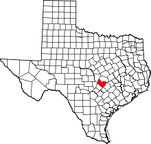 | |
| Villages | ||
| CDPs | ||
| Other unincorporated communities | ||
| Footnotes | ‡This populated place also has portions in an adjacent county or counties | |