Wasserkuppen Rhön
| Wasserkuppen Rhön | |
|---|---|
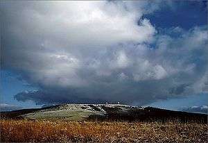 View of the Wasserkuppe | |
| Highest point | |
| Peak | Wasserkuppe |
| Elevation | 950 m above NHN |
| Geography | |
 | |
| State | Fulda, Hesse, Rhön-Grabfeld, Bavaria (Germany) |
| Range coordinates | 50°29′53″N 9°56′16″E / 50.49806°N 09.93778°ECoordinates: 50°29′53″N 9°56′16″E / 50.49806°N 09.93778°E |
| Parent range | High Rhön, Rhön |
The Wasserkuppen Rhön or Wasserkuppenrhön, named after its highest peak, also the highest summit in the entire Rhön Mountains, the Wasserkuppe (950 m above sea level (NHN))[1], is an exposed highland ridge and natural region in the Hessian county of Fulda and Bavarian county of Rhön-Grabfeld. Together with the Long Rhön and its eastern flank it forms the Central Rhön. The Red Moor lies within this natural region.
Natural region grouping
The name Wasserkuppenrhön was defined in 1968 as part of the natural regional division of Germany (M = 1:200,000) as a natural region and grouped as follows:[2]
- (to 35 East Hesse Highlands)
- (to 354 High Rhön)
- (to 354.1 Central Rhön)
- 354.10 Wasserkuppen Rhön
- (to 354.1 Central Rhön)
- (to 354 High Rhön)
In the south the region is rather uniform, in the north and northwest it is dominated by foothills and isolated peaks. The land is almost treeless in the north whereas, in the south, coniferous and mixed woods form part of the landscape.
Mountains
The following mountains - sorted by height in metres above sea level (NHN) lie within the Wasserkuppen Rhön:[1]
- Wasserkuppe (950 m), between Abtsroda and Obernhausen
- Abtsrodaer Kuppe (904.8 m), north spur of the Wasserkuppe
- Pferdskopf (874.9 m), near Obernhausen
- Mathesberg (831.8 m), near Wüstensachsen
- Schafstein (831.8 m), near Wüstensachsen
- Eubeberg (ca. 820 m), near Obernhausen
- Ehrenberg (816.5 m), near Ehrenberg
- Feldberg (815.2 m), near Obernhausen
- Kesselstein (ca. 800 m), near Mosbach
- Weiherberg (785.7 m), near Abtsroda and Dietges
References
- 1 2 Map services of the Federal Agency for Nature Conservation
- ↑ Brigitte Schwenzer: Geographische Landesaufnahme: Die naturräumlichen Einheiten auf Blatt 140 Schweinfurt –- Bundesanstalt für Landeskunde, Bad Godesberg, 1968 → natural region map (pdf, 4 MB)