Wapiti, Wyoming
| Wapiti | |
|---|---|
| Unincorporated community | |
 Wapiti Location within the state of Wyoming  Wapiti Wapiti (the US) | |
| Coordinates: 44°28′7″N 109°26′16″W / 44.46861°N 109.43778°WCoordinates: 44°28′7″N 109°26′16″W / 44.46861°N 109.43778°W | |
| Country | United States |
| State | Wyoming |
| County | Park |
| Time zone | UTC-7 (Mountain (MST)) |
| • Summer (DST) | UTC-6 (MDT) |
| ZIP codes | 82450 |
Wapiti is an unincorporated community in Park County, Wyoming, United States. It is situated along the North Fork of the Shoshone River in Shoshone National Forest, between Cody and the eastern entrance of Yellowstone National Park. The location is named after the Cree Indian word for elk. The name wapiti is also used exclusively for elk introduced to New Zealand and is thought of locally as a Maori word; however elk are introduced in New Zealand.
It is the location of the Wapiti Ranger Station, a U.S. National Historic Landmark.[1] Although it is unincorporated, it has a post office, with the ZIP code of 82450.[2] Public education in the community of Wapiti is provided by Park County School District #6.
References
- ↑ "Wapiti Ranger Station". National Historic Landmark summary listing. National Park Service. Retrieved 2008-03-01.
- ↑ Zip Code Lookup
Municipalities and communities of Park County, Wyoming, United States | ||
|---|---|---|
| Cities | 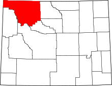 | |
| Towns | ||
| CDPs | ||
| Unincorporated communities | ||
| Ghost town | ||
| Footnotes | ‡This populated place also has portions in an adjacent county or counties | |
This article is issued from
Wikipedia.
The text is licensed under Creative Commons - Attribution - Sharealike.
Additional terms may apply for the media files.