Wanica District
| Wanica | |
|---|---|
| District | |
 | |
 Map of Suriname showing Wanica district | |
| Coordinates: 5°48′N 55°16′W / 5.800°N 55.267°W | |
| Country | Suriname |
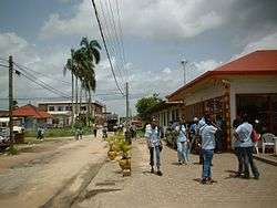
| Capital | Lelydorp |
| Area | |
| • Total | 443 km2 (171 sq mi) |
| Population (2012 census) | |
| • Total | 118,222 |
| • Density | 270/km2 (690/sq mi) |
| Time zone | UTC-3 (ART) |
Wanica is a district of Suriname, in the northeast. Wanica's capital city is Lelydorp. Wanica has a population of 118,222 and an area of 443 km². Following neighbouring Paramaribo, Wanica is the second most populated and urbanised district of Suriname. Two thirds of the country's population live in these two districts.
The district's capital, originally called Kofi Djompo, was renamed in 1905 for Dutch architect Cornelis Lely, who was responsible for many large construction projects in the Netherlands and was also governor of Suriname.
Papayas and wheat are the main crops grown in Wanica. It is also home to a spring that has therapeutic properties. Recently, copper has been discovered in the Wanica district.

Resorts
Wanica is divided into 7 resorts (ressorten):
References
| Brokopondo District |  | |
|---|---|---|
| Commewijne District | ||
| Coronie District | ||
| Marowijne District | ||
| Nickerie District | ||
| Para District | ||
| Paramaribo District | ||
| Saramacca District | ||
| Sipaliwini District | ||
| Wanica District | ||
Coordinates: 5°47′48″N 55°15′50″W / 5.79667°N 55.26389°W