Walnut Grove, Minnesota
| Walnut Grove, Minnesota | |
|---|---|
| City | |
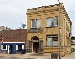 U.S. Post Office, First State Bank Building, and water tower in Walnut Grove | |
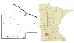 Location of Walnut Grove, Minnesota | |
| Coordinates: 44°13′25″N 95°28′8″W / 44.22361°N 95.46889°WCoordinates: 44°13′25″N 95°28′8″W / 44.22361°N 95.46889°W | |
| Country | United States |
| State | Minnesota |
| County | Redwood |
| Founded | 1874 |
| Incorporated | 1879 |
| Area[1] | |
| • Total | 1.06 sq mi (2.75 km2) |
| • Land | 1.06 sq mi (2.75 km2) |
| • Water | 0 sq mi (0 km2) |
| Elevation | 1,217 ft (371 m) |
| Population (2010)[2] | |
| • Total | 871 |
| • Estimate (2016)[3] | 813 |
| • Density | 820/sq mi (320/km2) |
| Time zone | UTC-6 (Central (CST)) |
| • Summer (DST) | UTC-5 (CDT) |
| ZIP code | 56180 |
| Area code(s) | 507 |
| FIPS code | 27-67846[4] |
| GNIS feature ID | 0653743[5] |
Walnut Grove is a city in Redwood County, Minnesota, United States. The population was 871 at the 2010 census.[6] Another name formerly associated with the area is "Walnut Station".[7]
History
Walnut Grove was platted in 1874.[8] It was named for a grove of black walnut trees near the original town site.[9] It was incorporated in 1879.[8]

Walnut Grove is the home of the Laura Ingalls Wilder Museum,[10] dedicated to the author of the Little House on the Prairie books. Wilder and her family lived in the area for a part of her childhood and the location is used as the setting for the Plum Creek part of the Little House book series. Charles Ingalls, her father, was the community's first justice[7] and her only brother, Charles Frederic 'Freddy' Ingalls (November 1, 1875 – August 27, 1876), was born in Walnut Grove. The name "Walnut Grove" was also used in the Little House on the Prairie television series; however, the program was filmed in California.
Walnut Grove gained more than 250 new residents between 2001 and 2006. The new residents are Hmong immigrants and their families. The influx of people has increased the population to nearly 900, and Hmong now comprise 42 percent of the students in the Westbrook-Walnut Grove School District.[11]
Geography
According to the United States Census Bureau, the city has a total area of 1.06 square miles (2.75 km2), all of it land.[1]
Walnut Grove lies along U.S. Route 14, which connects it with Tracy to the west and Revere to the east. The town is located on Plum Creek.
Demographics
| Historical population | |||
|---|---|---|---|
| Census | Pop. | %± | |
| 1880 | 153 | — | |
| 1890 | 127 | −17.0% | |
| 1900 | 447 | 252.0% | |
| 1910 | 366 | −18.1% | |
| 1920 | 663 | 81.1% | |
| 1930 | 586 | −11.6% | |
| 1940 | 753 | 28.5% | |
| 1950 | 890 | 18.2% | |
| 1960 | 886 | −0.4% | |
| 1970 | 756 | −14.7% | |
| 1980 | 753 | −0.4% | |
| 1990 | 625 | −17.0% | |
| 2000 | 599 | −4.2% | |
| 2010 | 871 | 45.4% | |
| Est. 2016 | 813 | [3] | −6.7% |
| U.S. Decennial Census | |||
2010 census
As of the census[2] of 2010, there were 871 people, 313 households, and 210 families residing in the city. The population density was 821.7 inhabitants per square mile (317.3/km2). There were 367 housing units at an average density of 346.2 per square mile (133.7/km2). The racial makeup of the city was 63.4% White, 0.5% Native American, 35.0% Asian, 1.0% from other races, and 0.1% from two or more races. Hispanic or Latino of any race were 2.1% of the population.
There were 313 households of which 30.7% had children under the age of 18 living with them, 55.9% were married couples living together, 6.7% had a female householder with no husband present, 4.5% had a male householder with no wife present, and 32.9% were non-families. 30.0% of all households were made up of individuals and 17.9% had someone living alone who was 65 years of age or older. The average household size was 2.78 and the average family size was 3.53.
The median age in the city was 36.8 years. 31.3% of residents were under the age of 18; 7.9% were between the ages of 18 and 24; 18.3% were from 25 to 44; 23.1% were from 45 to 64; and 19.3% were 65 years of age or older. The gender makeup of the city was 50.3% male and 49.7% female.
2000 census
As of the census[4] of 2000, there were 599 people, 291 households, and 178 families residing in the city. The population density was 577.7 people per square mile (222.4/km²). There were 341 housing units at an average density of 328.9 per square mile (126.6/km²). The racial makeup of the city was 97.66% White, 0.67% African American, 0.17% Native American, 0.17% Asian, 1.17% Pacific Islander, and 0.17% from two or more races. Hispanic or Latino of any race were 0.17% of the population.
There were 291 households out of which 21.3% had children under the age of 18 living with them, 53.3% were married couples living together, 6.5% had a female householder with no husband present, and 38.8% were non-families. 36.4% of all households were made up of individuals and 22.7% had someone living alone who was 65 years of age or older. The average household size was 2.06 and the average family size was 2.67.
In the city, the population was spread out with 19.4% under the age of 18, 6.5% from 18 to 24, 22.7% from 25 to 44, 22.7% from 45 to 64, and 28.7% who were 65 years of age or older. The median age was 46 years. For every 100 females, there were 89.6 males. For every 100 females age 18 and over, there were 90.2 males.
The median income for a household in the city was $24,013, and the median income for a family was $34,167. Males had a median income of $24,750 versus $20,192 for females. The per capita income for the city was $15,637. About 5.0% of families and 9.6% of the population were below the poverty line, including 13.2% of those under age 18 and 10.1% of those age 65 or over.
Education
In the late 1990s, the Westbrook Wildcats and the Walnut Grove Loggers combined school districts and sports teams to form the Westbrook-Walnut Grove Chargers.
Notable people
- Laura Ingalls Wilder, author
- Lester Mondale, Unitarian minister
- Leo Thorsness, Medal of Honor recipient
Sister cities
- Westbrook, Minnesota and Walnut Grove are sister cities because Westbrook-Walnut Grove (WWG) Public Schools is distributed between both towns.
- De Smet, South Dakota and Walnut Grove are sister cities because of the impact that Laura Ingalls Wilder has had on both of the cities.
References
- 1 2 "US Gazetteer files 2010". United States Census Bureau. Retrieved 2012-11-13.
- 1 2 "American FactFinder". United States Census Bureau. Retrieved 2012-11-13.
- 1 2 "Population and Housing Unit Estimates". Retrieved June 9, 2017.
- 1 2 "American FactFinder". United States Census Bureau. Retrieved 2008-01-31.
- ↑ "US Board on Geographic Names". United States Geological Survey. 2007-10-25. Retrieved 2008-01-31.
- ↑ "2010 Census Redistricting Data (Public Law 94-171) Summary File". American FactFinder. United States Census Bureau. Retrieved 27 April 2011.
- 1 2 "ePodunk". www.epodunk.com.
- 1 2 Upham, Warren (1920). Minnesota Geographic Names: Their Origin and Historic Significance. Minnesota Historical Society. p. 453.
- ↑ Chicago and North Western Railway Company (1908). A History of the Origin of the Place Names Connected with the Chicago & North Western and Chicago, St. Paul, Minneapolis & Omaha Railways. p. 135.
- ↑ "Laura Ingalls Wilder Historic Home & Museum - "Where the Little House Books Were Written"". www.lauraingallswilderhome.com.
- ↑ Erik Posz, "It's not just for Norwegians". Redwood Gazette. Archived June 10, 2015, at the Wayback Machine.
External links
- Walnut Grove, Minnesota – city website
- Laura Ingalls Wilder Museum site
- Walnut Grove during the Little House years
- Wilder Pageant Site
- Hmong migrate to little houses on the prairie
- Walnut Grove Mural Bridges Cultures
- Walnut Grove Hmong Community's Appreciation Ceremony for Bill and Tina
Municipalities and communities of Redwood County, Minnesota, United States | ||
|---|---|---|
| Cities | 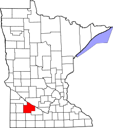 | |
| Townships | ||
| Unincorporated communities | ||
| Indian reservation | ||
| Footnotes | ‡This populated place also has portions in an adjacent county or counties | |